Vallunga – An Oasis of Tranquillity in the Dolomites
During our last trip to the Dolomites, we stayed at Vista Dolomites in Santa Cristina Val Gardena, a peacefully located accommodation with stunning views of the surrounding mountains. From here, it’s just a few minutes’ drive to the Vallunga valley. A beautiful location with fantastic hiking opportunities. Afterwards, you can treat yourself at La Ciajota at the entrance to the valley.

About Vallunga
Vallunga (German: Langental, Italian: Valle Lunga) is an idyllic U-shaped valley that stretches from Selva di Val Gardena deep into the Puez-Odle Nature Park. The name literally means “long valley” – and at approximately 4.5 kilometres in length, the valley certainly lives up to its name.
What makes Vallunga so special is the complete absence of buildings, roads, and cable cars. Here you’ll find only nature in its purest form: expansive alpine meadows where cows and sheep graze peacefully, dense larch and pine forests, and imposing rock walls that enclose the valley on both sides. It’s a place where time seems to stand still.
The valley is part of the UNESCO World Heritage Dolomites and forms the gateway to the Puez-Odle Nature Park – one of the most beautiful protected areas in South Tyrol. With 10,722 hectares of unspoilt nature, this park provides a home to ibex, chamois, marmots, eagles, and countless other alpine animals.
| Location | Selva di Val Gardena, Puez-Odle Nature Park |
| Valley length | ~4.5 km (one way) |
| Elevation gain | ~250 m (1,550 – 1,800 m) |
| Nature park | Puez-Odle / Puez-Geisler (10,722 ha) |
| Status | UNESCO World Heritage Dolomites |
| GPS Car park | 46.5641° N, 11.7726° E |
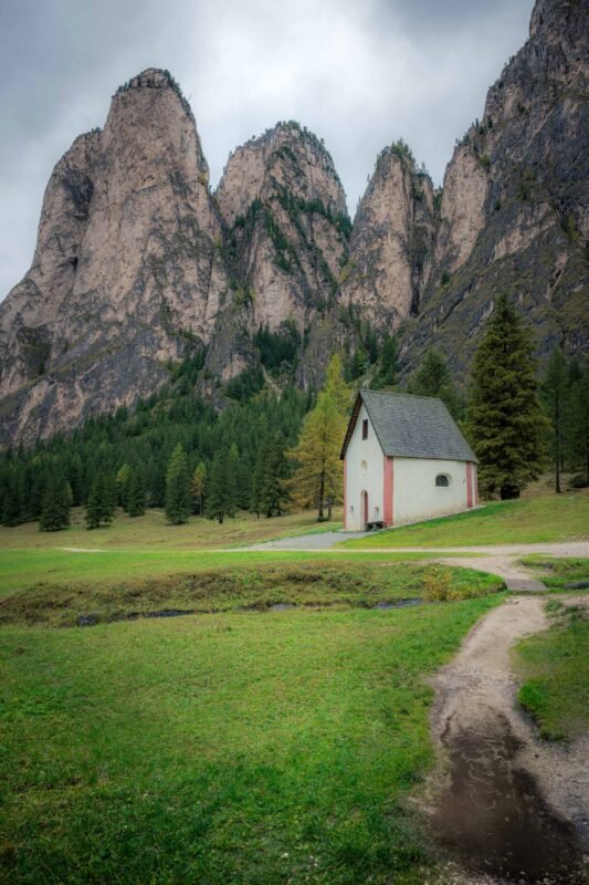
St Sylvester’s Chapel
Right at the entrance to the valley, just five minutes’ walk from the car park, stands St Sylvester’s Chapel (Cappella di San Silvestro). This small, charming chapel is dedicated to the patron saint of cattle – not surprising given the centuries-old tradition of livestock farming in this valley.
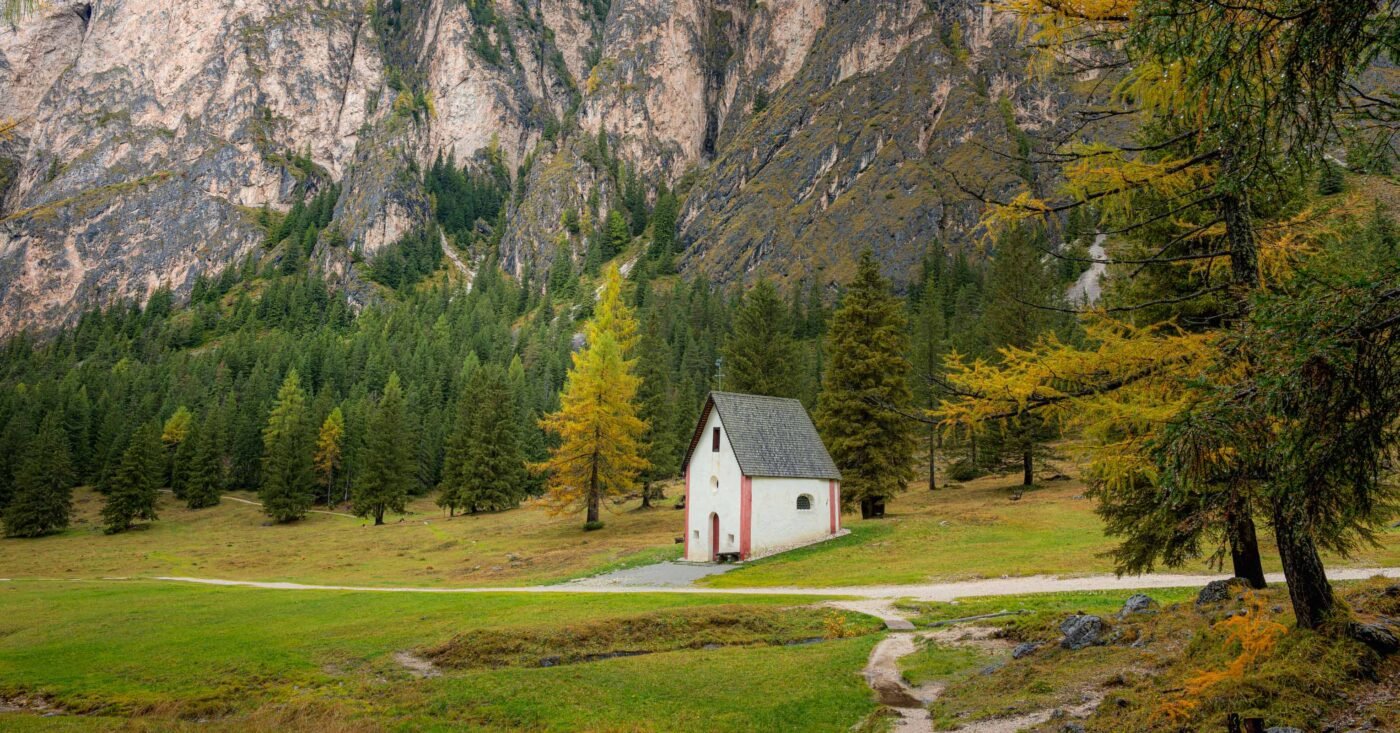
During restoration work in 1993, 300-year-old frescoes were discovered depicting the life of Jesus. The chapel makes a perfect first stop on your walk and, with the imposing Steviola Tower in the background, offers a wonderful photo opportunity.
Location and How to Get There
Vallunga lies at the end of Val Gardena (Grödnertal), right next to the village of Selva di Val Gardena (Wolkenstein). The valley is easily accessible by car, but also by public transport.
| From Selva di Val Gardena | ~2.7 km (~7 min) |
| From Santa Cristina | ~5.2 km (~10 min) |
| From Ortisei | ~9.2 km (~15 min) |
| From Bolzano | ~45 km (~50 min) |
| Parking | Paid, €0.50 per 30 min (max €8/day) |
Driving Directions
From the Brenner motorway (A22), drive via the SS242 through Val Gardena towards Selva. Just before Selva (after Hotel Alpenroyal), turn left and immediately right again, towards Streda Val. Follow this narrow road to the car park at the La Ciajota kiosk. The car park is located behind the carabinieri barracks.
Tip: Arrive early! The car park is limited and can fill up quickly in peak season. In the morning, you’ll usually still find a spot easily.
Public Transport
- Bus line 350: Every half hour from Ponte Gardena or Chiusa to Selva. Get off at the “Nives” stop in the centre, then ~20 min walk to Vallunga
- Bus line 357: Summer bus direct to the “Vallunga” stop – then ~15 min walk to the car park/trailhead
The Surrounding Area
Val Gardena and its surroundings offer plenty of opportunities to combine your visit to Vallunga with other activities:
Natural Highlights
- Prà da Ri: The large alpine meadow at the end of the valley (1,800 m) – ideal for a picnic
- St Sylvester’s Chapel: Historic chapel with 300-year-old frescoes at the valley entrance
- Rifugio Puez: Mountain hut at 2,475 m, accessible via an extended route through the nature park
- Val de Chedul: Adjacent side valley for more extensive hikes
Nearby
- Seceda: The iconic Odle mountain ridge, accessible by cable car (~10 min drive)
- Passo Gardena: Spectacular mountain pass with views of the Sella Group (~15 min drive)
- Sassolungo: Imposing mountain peak, starting point for the Sassolungo circuit hike
- Seiser Alm: Europe’s largest high-altitude alpine meadow (~25 min drive)
Photography in Vallunga
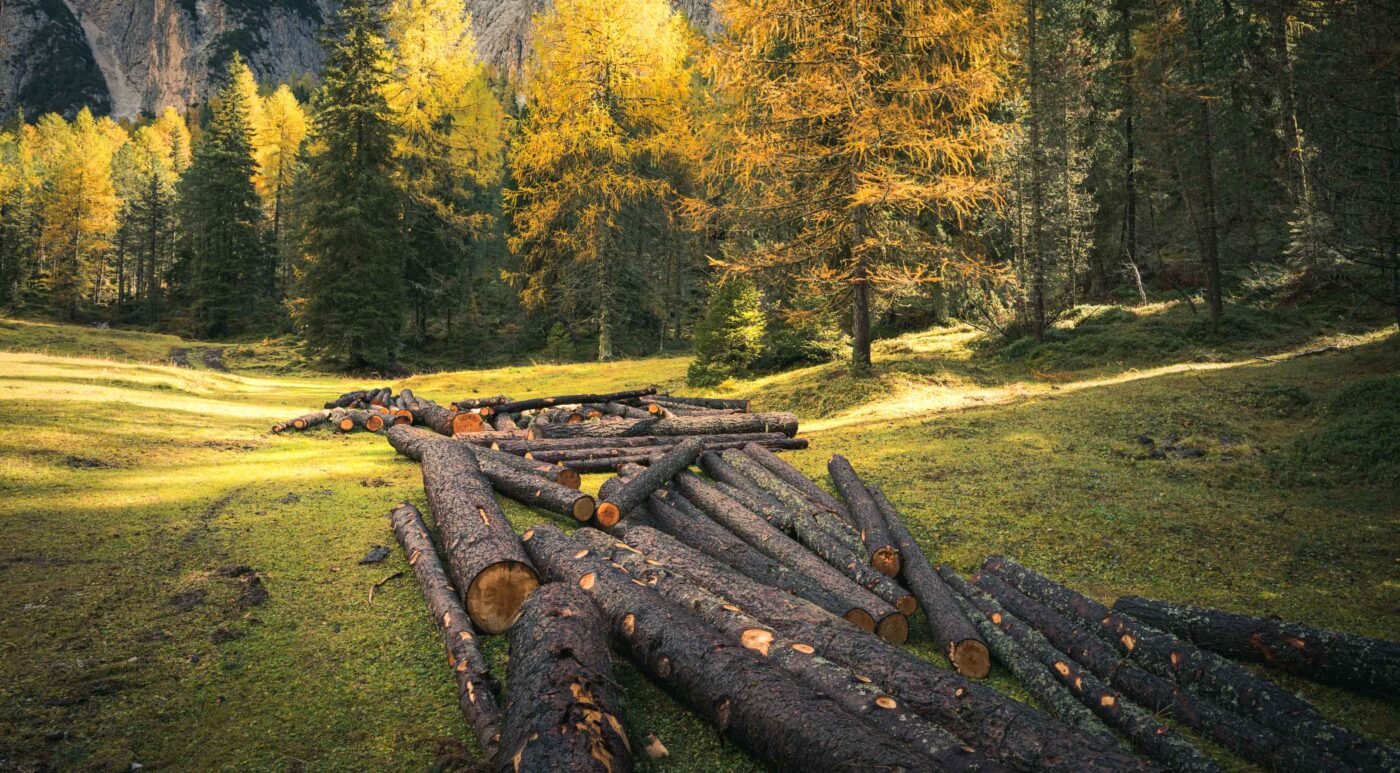
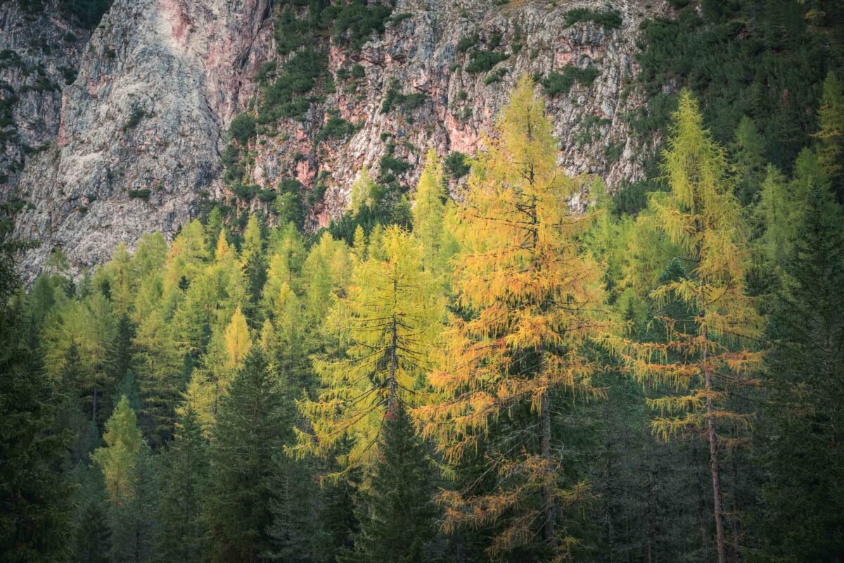
Vallunga is a dream for photographers. The combination of meadow, forest, and imposing rock walls offers endless possibilities, especially in autumn when the larches turn golden yellow.

Photography tip – Golden Hour: The valley runs east-west, so the morning light beautifully illuminates the rock walls on the north side. Plan your walk early for the best light on St Sylvester’s Chapel and the mountain peaks.
Photography tip – Autumn: October is the absolute highlight for photography in Vallunga. The larches (European larch) turn bright yellow and orange, creating a stunning contrast with the grey rock walls and green pines. Late October is usually the best time.
Equipment: A telephoto lens (70-200mm) is handy for photographing chamois and marmots on the steep slopes. For landscapes, a standard zoom lens (24-70mm) will suffice. A wide-angle can work beautifully at the chapel with the mountains in the background.
Walking Routes at Vallunga
The most obvious route is, of course, a loop through the valley. Depending on your preferences, you can make it as long or short as you like. We chose this route that takes you to the end and offers the most beautiful views along the way.
Route 1: Vallunga Valley Walk (Easy)
The classic walk through the valley is perfect for families, beginner hikers, or anyone looking for a relaxing day in nature. The path (no. 14) is wide, well-maintained, and you can’t get lost – the steep rock walls on both sides form a natural boundary.
| Distance | ~9 km (return) |
| Duration | 2.5-3 hours |
| Elevation gain | ~250 m |
| Difficulty | Easy |
| Start/Finish | Vallunga car park |
| Trail number | 14 |
Route Description
From the car park, you first walk past the La Ciajota kiosk and after five minutes you reach St Sylvester’s Chapel. Here the path splits: left goes via a gentle incline through the forest, right takes the easier route directly across the meadows. Both paths rejoin further along.
You walk through alternating forest and open meadows, with constantly surprising views of the surrounding mountain peaks. After about 3 km, you reach a beautiful open meadow – a perfect spot for a break. The path gradually narrows as you continue.
The endpoint is the large alpine meadow Prà da Ri at 1,800 metres, where cows graze peacefully among large boulders. This is the ideal spot for a picnic before returning via the same path.
Extensions for Experienced Hikers
From Vallunga, you can continue to the Puez-Odle high plateau for more challenging hikes:
- To Rifugio Puez (2,475 m): +3-4 hours, steep climb via trail 14 – spectacular views over the valley
- Via Val de Chedul circuit: ~6-7 hours, via the Crespëina high plateau and Rifugio Puez back to Vallunga
- To the Cir peaks: Spectacular day trip via Passo Cir to Rifugio Jimmy and back by cable car
Best Time to Visit
Vallunga is accessible year-round, but each season has its own charm.
| May-June | Spring flowers, green meadows, possibly still snow patches higher up |
| July-August | Peak season, busy but beautiful weather, all routes open |
| September-October | Autumn colours! Larches turn golden yellow, quieter than summer |
| November-April | Winter hiking and snowshoeing, cross-country ski track in the valley |
Tip: For the ultimate autumn colours experience, late October is the best time. The larches are at their most beautiful and the summer crowds have gone. Plus, parking costs are lower as there are fewer visitors.
Accommodation in the Area
Val Gardena offers accommodation for every budget, from cosy B&Bs to luxury wellness hotels. The three main villages are all excellent bases:
Accommodation Options
- Selva di Val Gardena: Closest to Vallunga, vibrant centre with many restaurants and shops
- Santa Cristina: More peaceful location, we stayed here at Vista Dolomites with stunning views
- Ortisei: Largest village in Val Gardena, extensive range of accommodation and facilities
Practical Information
Costs (2025)
| Vallunga access | Free |
| Parking | €0.50 per 30 min / max €8 per day |
| Parking machine | Coins or card (not always reliable) |
| Payment hours | 9:00 – 17:00 |
Tip: Bring coins! The card reader doesn’t always work and the machine doesn’t give change.
Facilities
- La Ciajota: Kiosk at the car park with light meals and homemade cakes (closed on Wednesdays)
- Baita Ciampac: Mountain hut near the car park with a more extensive menu
- Toilets: No toilets in the valley itself – use the facilities at La Ciajota before setting off
- Picnic tables: Several picnic spots with tables and benches along the path
What to Bring
- Good walking shoes: The path is wide but can be rocky and uneven
- Picnic: No eating facilities in the valley – bring lunch and plenty of water
- Binoculars: To spot chamois and marmots on the slopes
- Sunscreen and hat: Little shade on the open meadows
- Rain jacket: The weather can change quickly in the mountains
Nature Park Rules
- Dogs on lead: Required due to grazing livestock
- No cycling: Mountain biking is not permitted in the valley
- No picking: Collecting flowers, mushrooms, and minerals is prohibited
- Leave No Trace: Take all your rubbish back with you
Frequently Asked Questions
How long does the walk through Vallunga take?
The standard walk to the end of the valley (Prà da Ri) and back takes 2.5-3 hours for the 9 km. Allow extra time for photo stops and a picnic – most people spend half a day in the valley.
Is Vallunga suitable for children?
Absolutely! Vallunga is one of the best family walks in the Dolomites. The path is wide and flat, there are streams to play in, boulders to climb, and cows and sheep to watch. Children love it.
Can you buy food and drink along the way?
There are no eating facilities in the valley itself. Bring a picnic! At the car park, you’ll find the La Ciajota kiosk (closed on Wednesdays) and Baita Ciampac for a bite after your walk.
When is the best time to visit Vallunga?
For the famous autumn colours, late October is ideal. Summer (July-August) offers the best weather but is busier. The valley is also accessible in winter for snowshoeing and cross-country skiing enthusiasts.
How much does parking at Vallunga cost?
Parking costs €0.50 per half hour, with a maximum of €8 per day. Payment hours are from 9:00 to 17:00. Bring coins – the card reader doesn’t always work.
Can I combine Vallunga with other hikes?
Yes! Experienced hikers can continue to Rifugio Puez (2,475 m) or do a circuit hike via Val de Chedul. From Vallunga, you can also continue to the Cir peaks for a spectacular day trip.
Final Thoughts
Vallunga is one of those rare places in the Dolomites where you can escape the crowds of mass tourism. No cable cars, no mountain huts halfway along, no cars – just you and nature. It’s the perfect destination for a relaxing walk, a family outing, or a recovery day between more challenging mountain hikes.
The combination of accessibility and unspoilt nature makes Vallunga unique. Whether you come for the autumn colours, the wildlife, or simply to enjoy the silence – this valley won’t disappoint. Bring a picnic, find a nice spot on one of the large boulders, and enjoy one of the most beautiful hidden gems of Val Gardena.
In my photo book Dolomites – A Journey Through Breathtaking Heights, you can get a wonderful impression of this magnificent region through many beautiful photographs. Most locations also include QR codes giving you direct access to additional location information.
Useful Links
- Val Gardena Tourism – valgardena.it
- Puez-Odle Nature Park – nature-parks.province.bz.it
- South Tyrol Public Transport – suedtirolmobil.info
- Val Gardena Hiking Routes – val-gardena.com
- La Ciajota – val-gardena.com
Location on Map
Related Articles
- Tre Cime di Lavaredo – The Three Peaks of the Dolomites
- Lago Federa – Hidden mountain lake in the Dolomites
- Lago di Braies – The pearl of the Dolomites
- Val di Funes – The magic of Santa Maddalena
- Seceda and Col Raiser – Spectacular mountain peaks
- Seiser Alm – The high plateau of the Dolomites
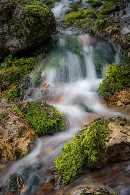
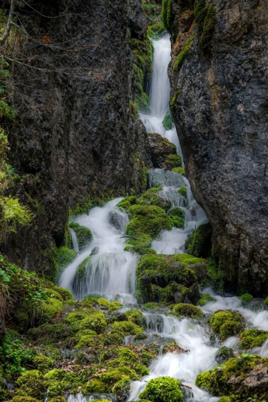
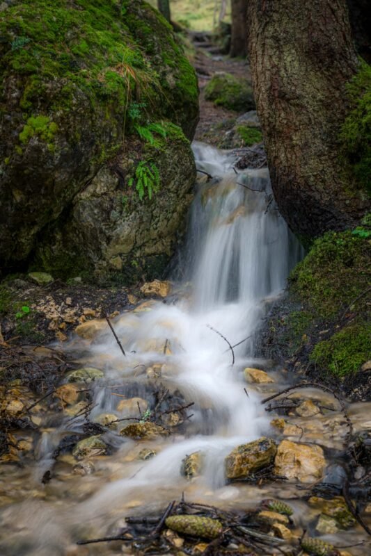
Gallery
Pictures speak louder than words: