Lago Fedèra – Dolomites, Italy

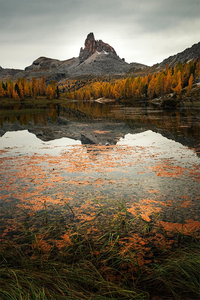
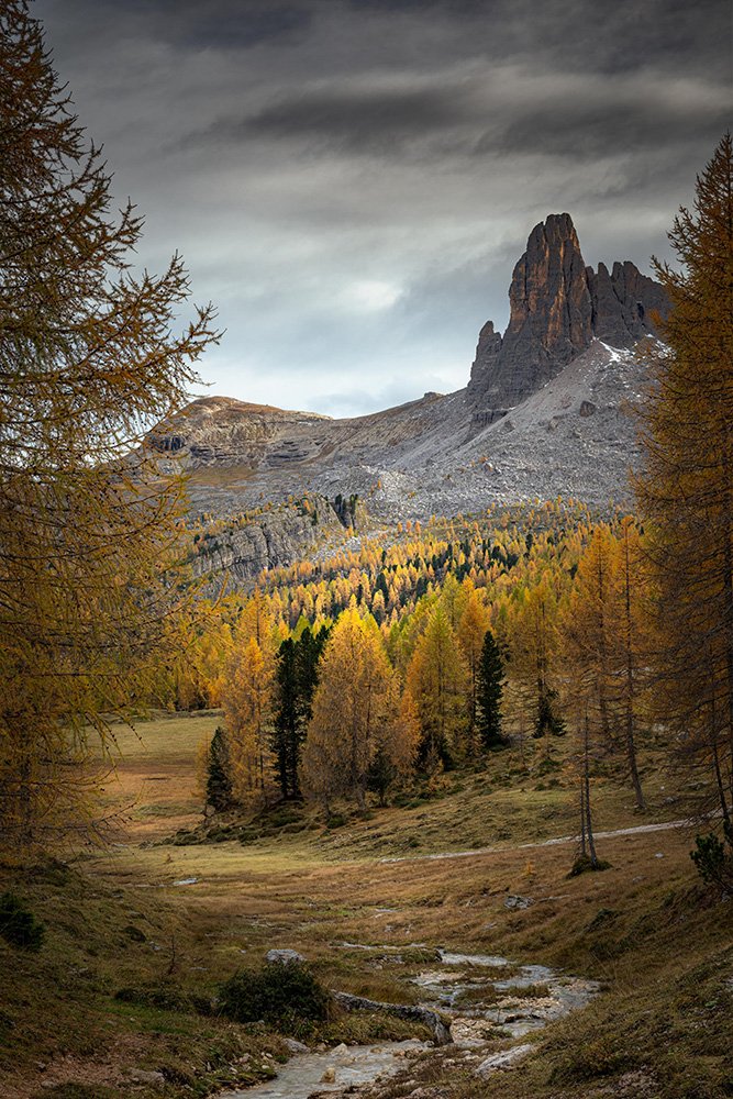
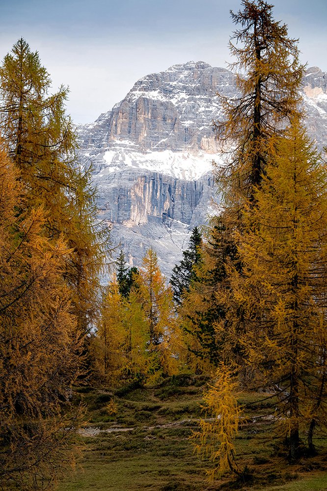
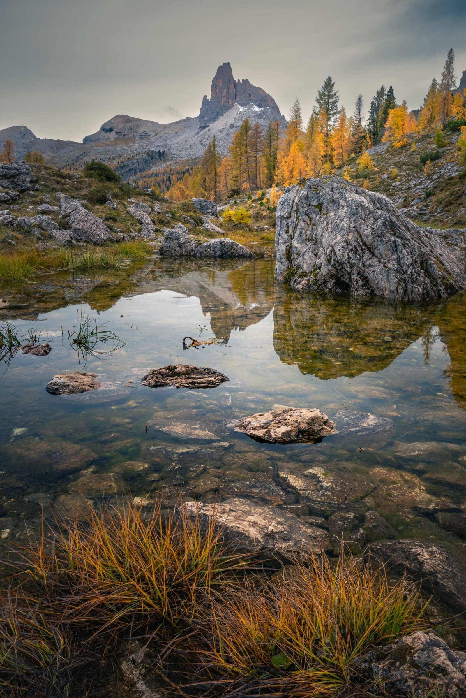
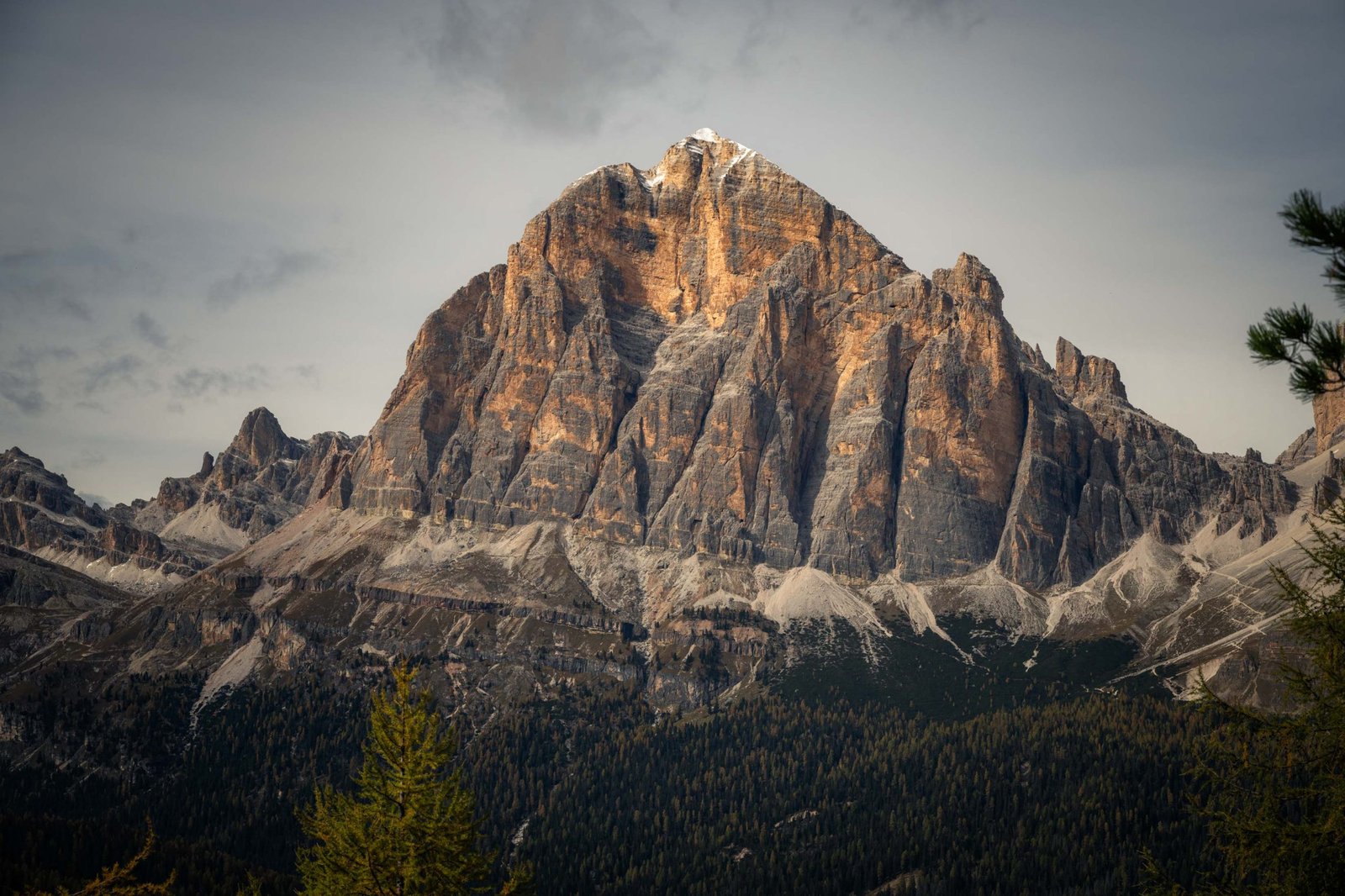
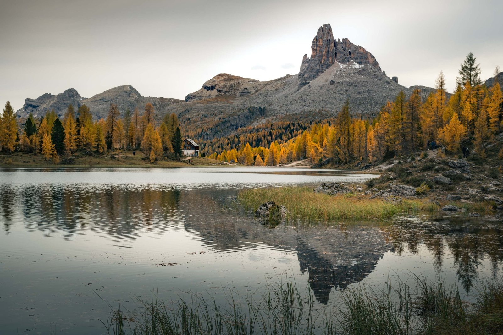
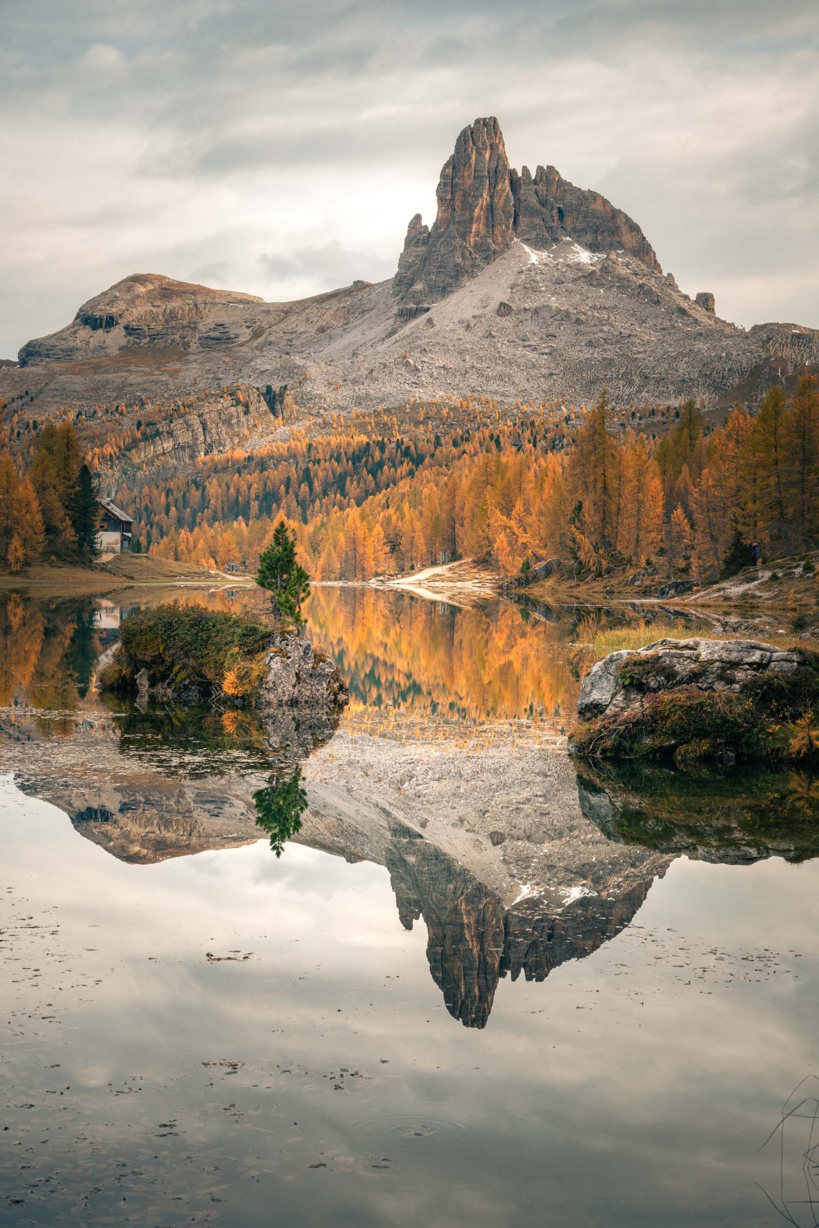
Lago Fedèra is a stunning alpine lake located at an elevation of approximately 2,038 meters in the Dolomites, near Cortina d'Ampezzo in the Veneto region of Italy. Nestled beneath the eastern wall of Croda da Lago and offering breathtaking views of the iconic Becco di Mezzodì peak, the lake is known for its tranquil beauty and lush surroundings. Encircled by larch forests, which turn golden in autumn, the area is a favorite destination for hikers and nature lovers. Nearby, Rifugio Croda da Lago – Gianni Palmieri provides a cozy spot for refreshments and rest, enhancing the charm of this serene location.
Where is it?
Gallery
Photography tips
-
- Best Time: Mid-morning to avoid harsh shadows on the trail.
-
- Recommended gear tip: Use a polarizing filter to reduce glare and enhance the lake’s vivid color.
-
- Autumn Splendor: Autumn is an especially photogenic season, with larch trees cloaked in warm hues, creating a dramatic contrast against the crisp blue waters.
- Mountain Reflections: On calm days, the lake's surface mirrors the Croda da Lago peaks and the iconic Becco di Mezzodì, offering perfect opportunities for symmetrical compositions.
- Foreground Interest: Incorporate natural elements such as boulders, wildflowers, or the shoreline to add depth and texture to your images.
Hiking tips
-
- Starting point: Start at the parking space Ponte de Ru Curto, trail number 437.
- Trail Access: The hike to Lago Fedèra is accessible via trails from Campo di Sotto or other nearby starting points in Cortina d'Ampezzo. The routes are well-marked and moderately challenging.
- Best Seasons: The ideal time to hike is from late spring to early autumn, though snow may persist into early summer. Always check trail conditions beforehand.
- Facilities: Rifugio Croda da Lago – Gianni Palmieri is a great place to take a break during your hike, offering food and a rustic atmosphere. Plan your hike around its opening times.
- Safety Preparation: Wear sturdy hiking boots, bring sufficient water and snacks, and dress appropriately for variable mountain weather. A map or GPS is also recommended.