Hammershus – Ruins, Wind and Light at the Edge of Bornholm
I’ve written about it before and even created a book about it, Bornholm – Pearl of the Baltic Sea. It’s an island with many faces. You could say, Denmark in miniature. The most beautiful beaches in the south to rugged rocky coasts to the north. In between, charming harbor towns. And let’s not forget the treats you encounter on the island, like the excellent smoked salmon.
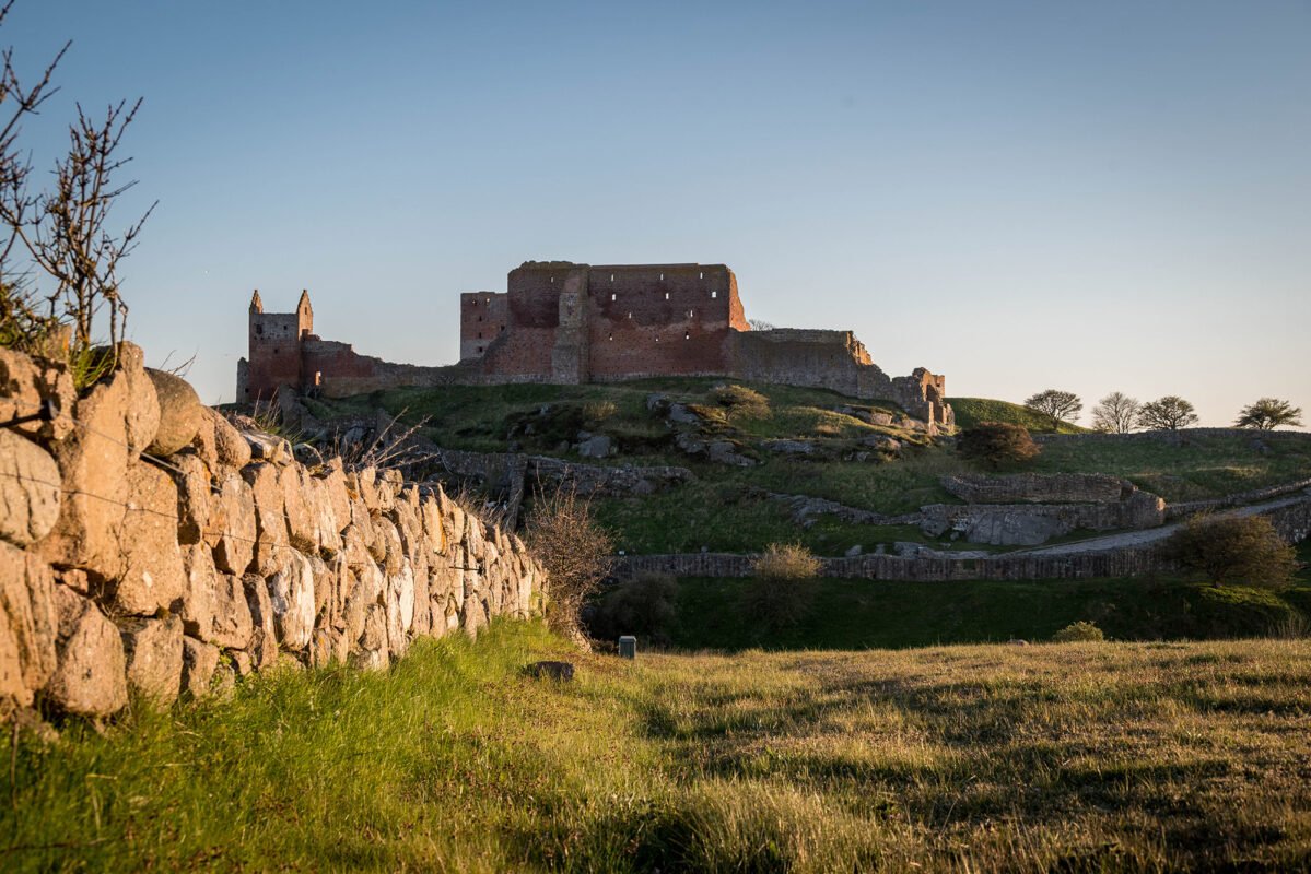
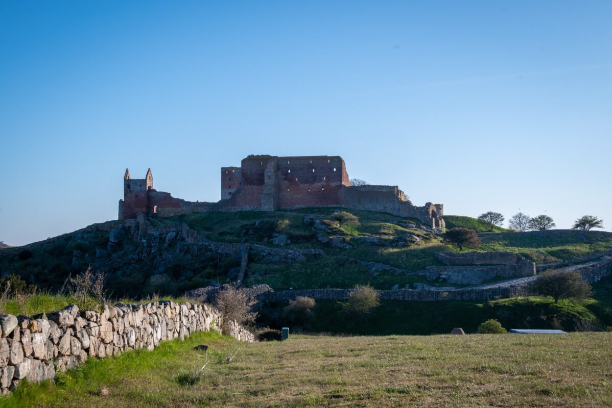
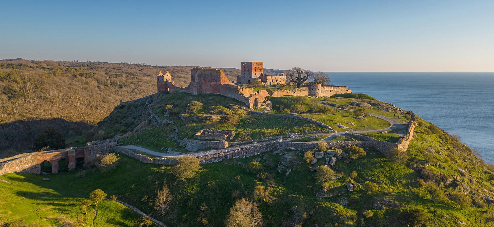
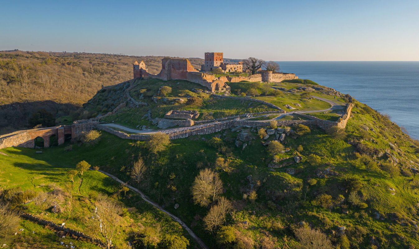
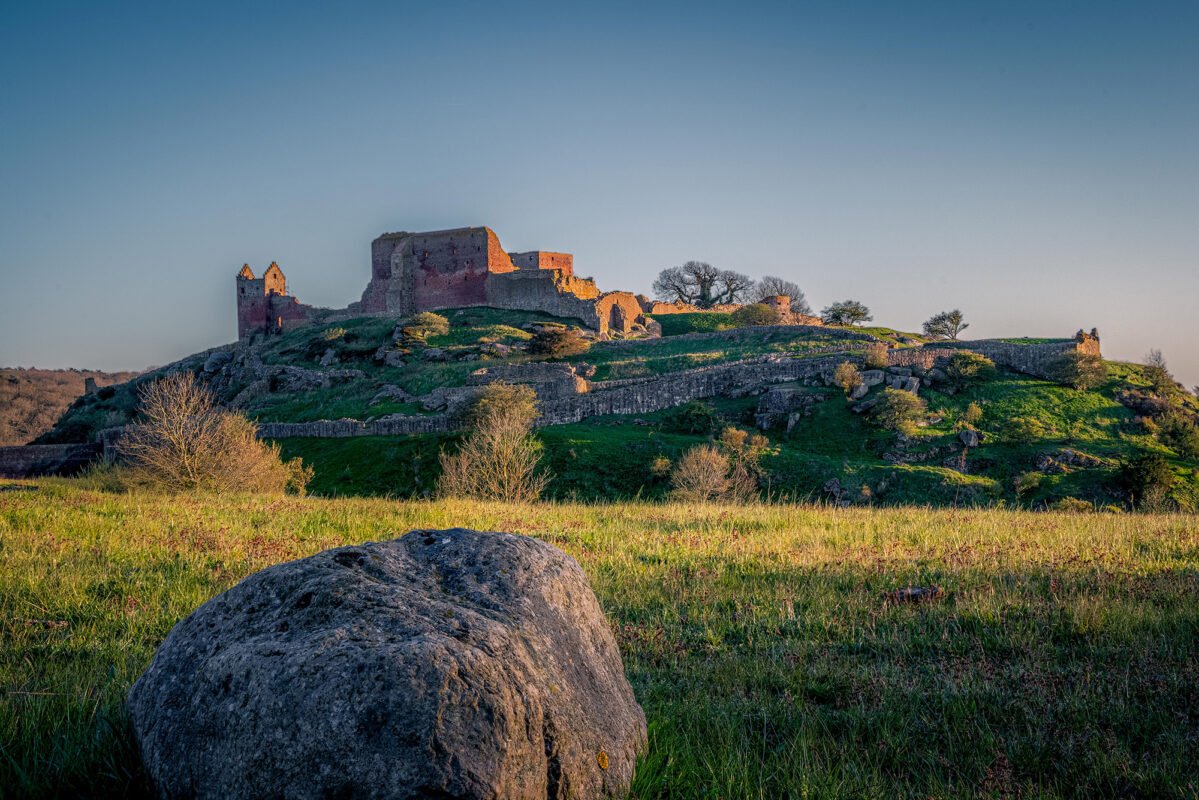
On the north coast of Bornholm, high above the Baltic Sea, lie the ruins of Hammershus. During our stay on the island, we returned here multiple times.
Location and Accessibility
Hammershus is located on the northwest coast of Bornholm, between Allinge and Sandvig. From both towns, the ruin is easily accessible by car, bicycle, or on foot. There’s a large parking lot at the visitor center, from where you can walk to the ruins in a short time.
Hammershus is not a closed attraction. You walk around freely, between walls, towers and open spaces, with views of cliffs and water. It doesn’t feel like a museum, but like a landscape where history has become part of nature. During the day, the visitor center is open. But even when it’s closed, you have free access to Hammershus.
Depending on your starting point, you can reach Bornholm in different ways. In most cases, that’s by ferry. We always choose the ferry from Sassnitz in Germany to Rønne.
History of Hammershus
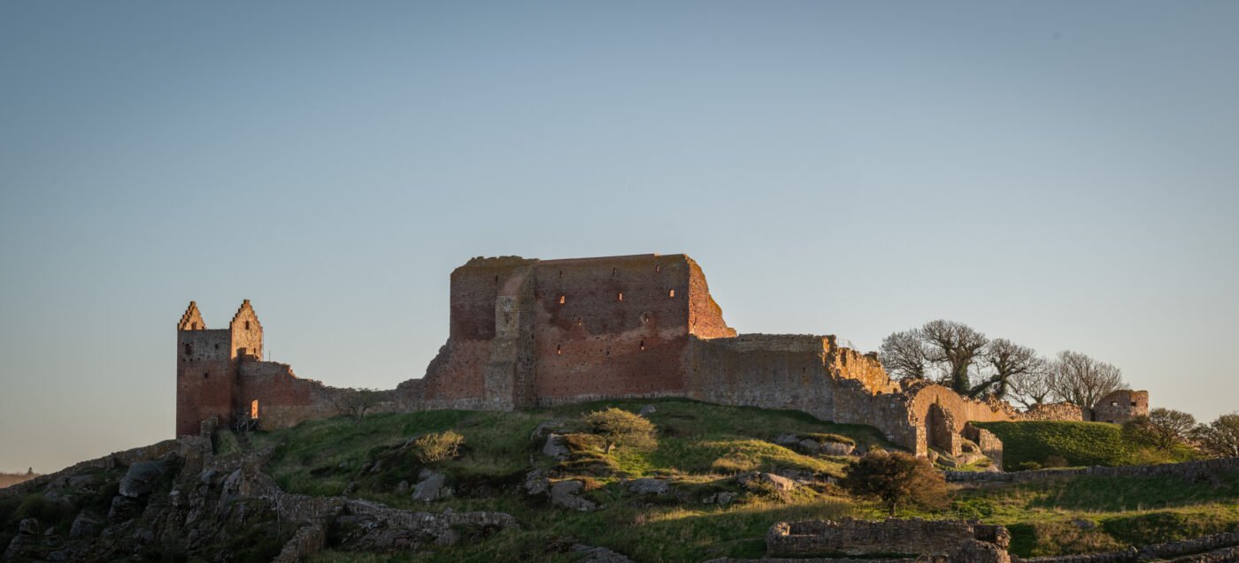
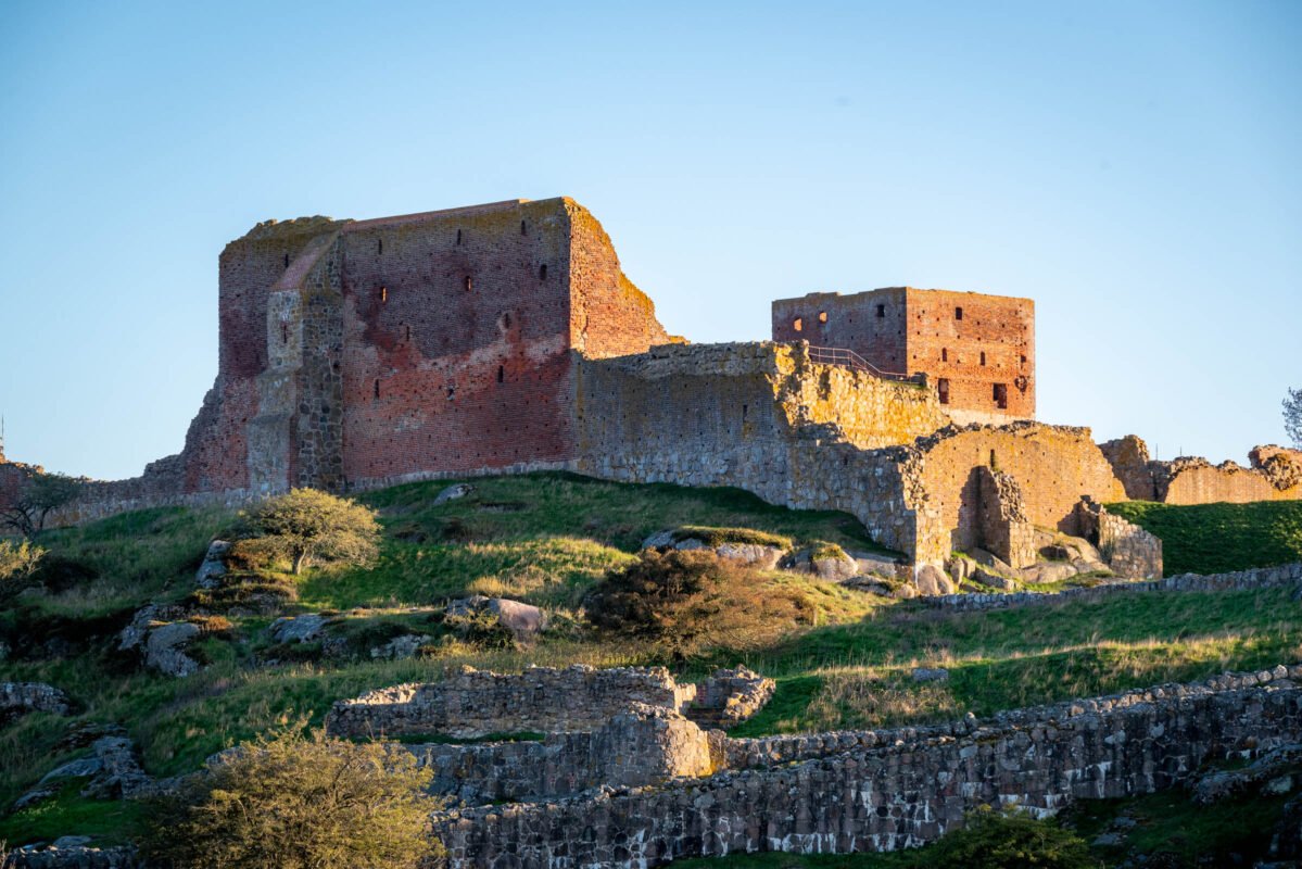
Hammershus is the largest medieval ruin in Northern Europe. The castle was probably completed around the year 1300 and built by Archbishop Jens Grand of Lund (1289-1302). New research from 2015 has shown that the castle is younger than previously thought – not from the 12th century, but from the 13th century.
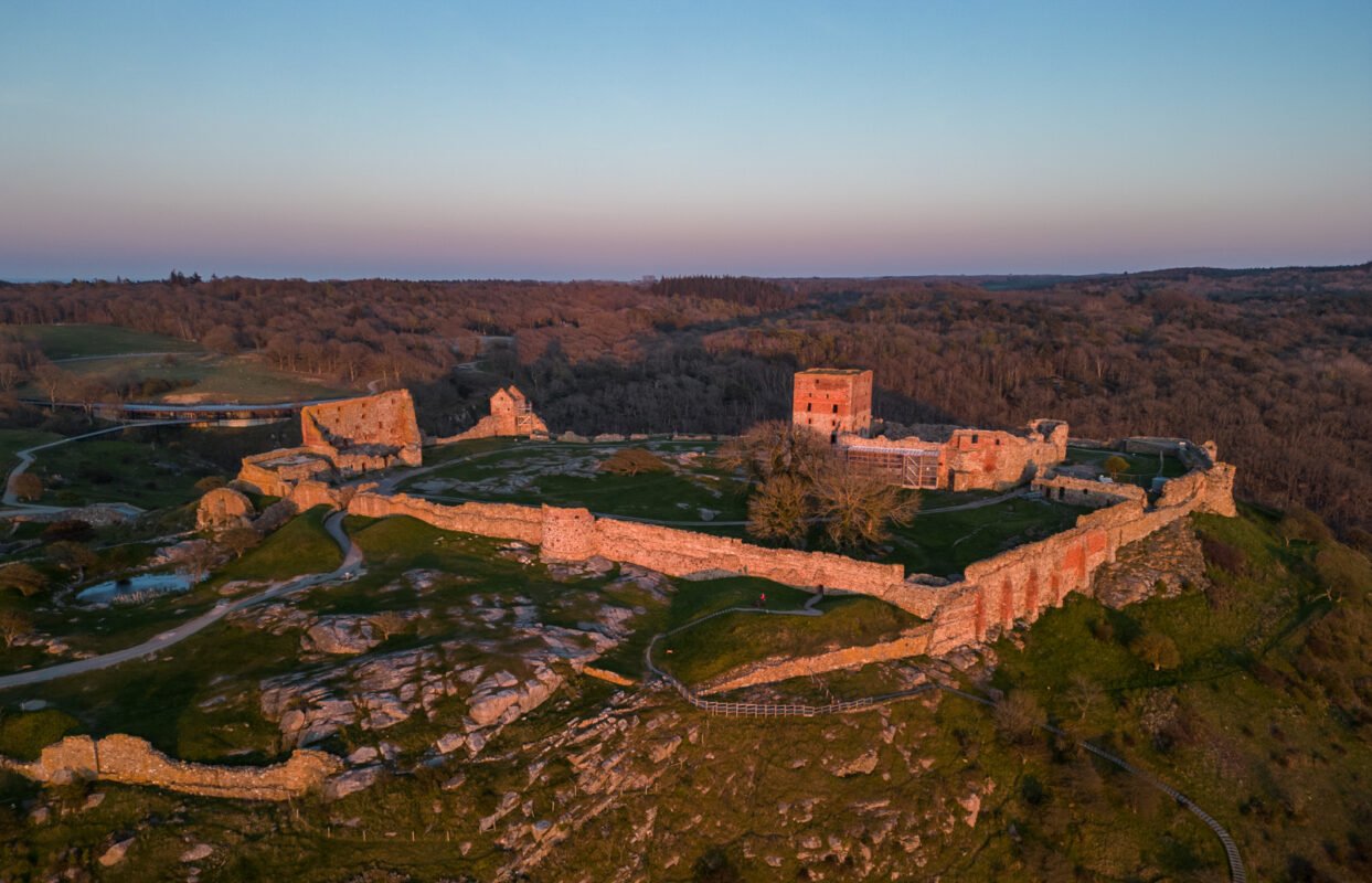
Once, Hammershus was a center of power, strategically located 74 meters above sea level. The fortress played a crucial role in the power struggle between the Danish crown and the church. For 500 years, Hammershus was the stronghold of the various rulers of Bornholm.
A dramatic chapter in the history of Hammershus took place in 1660-1661, when Leonora Christina (daughter of King Christian IV) and her husband Corfitz Ulfeldt were imprisoned here for high treason. A spectacular escape attempt via the walls and cliffs failed.
In 1743, Hammershus was permanently abandoned as a fortress. Until 1822, inhabitants of Bornholm were allowed to take stones from the ruin as building material. In that year, the complex was protected as a historical monument. Today, it is mainly the open structures that make an impression: walls without roofs, passages without doors, and towers that frame the landscape.
Hammershus and its Surroundings
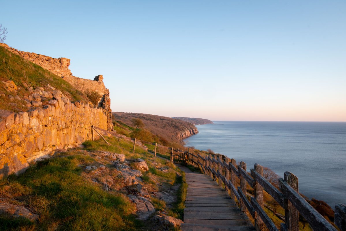
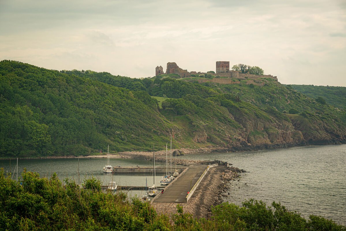
Directly around the ruin lies a rugged coastal landscape. Rocky slopes descend to the sea, and hiking trails follow the contours of the cliffs. The contrast between stone, water and sky makes this place particularly suitable for slow exploration.
In the bay approximately 100 meters west of the castle ruins, you can see remarkable rock formations in the water: the so-called camel and lion heads. These natural sculptures are clearly visible from the coastal path.
Photography at Hammershus: Tips and Best Times
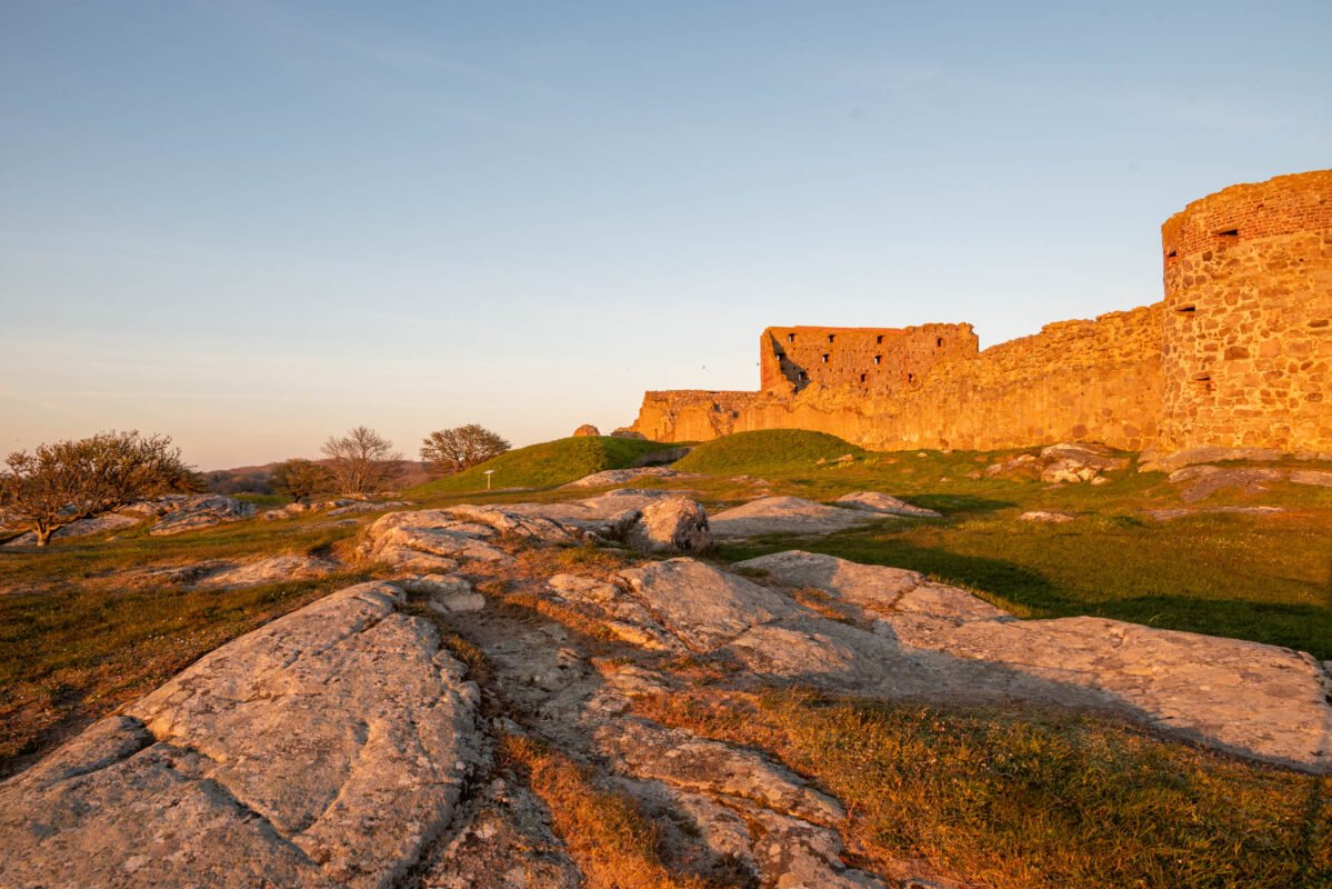
For photographers, Hammershus is a location where you need to take your time. It’s not a place for one viewpoint or quick photos. Light, clouds and wind constantly change here, and that determines the image.
Pro Tip: If you’re going purely for photography, go in the evening. At sunset, it’s a beautiful location due to its western position overlooking the Baltic Sea.
In the morning, the light is often low and soft, with long shadows between the walls. Later in the day, more contrast develops, especially when clouds move across the sea. Backlighting works well here: open windows and passages become silhouettes, while the sea lights up.
Even in less “perfect” weather, Hammershus is strong. Fog, rain or strong wind actually enhance the rugged character. The ruins then seem part of the landscape, not a separate object.
Best Times for Photography:
- Sunrise: Soft colors from the east side
- Sunset: Dramatic light over the Baltic Sea (best option)
- Golden hour: About 1 hour before sunset
- Cloudy weather: Dramatic skies, fewer tourists
- After rain: Clear air and intense colors
Drone Photography: The location is excellent for drone photography. However, keep in mind that drone use can be sensitive given the island’s location in the Baltic Sea.
Hammershus Hiking Route: Along the Coast from Vang Harbor
The route starts at Vang harbor. Then it goes northward along the coast. It’s a spectacular hiking route that regularly treats you to beautiful nature and views.
Route Details
| Distance | 16.6 km (loop) |
| Duration | 4-5 hours (depending on pace and stops) |
| Difficulty | Moderate – uneven terrain with elevation changes |
| Elevation gain | 270m up ↗ / 270m down ↘ |
| Start/Finish | Vang harbor (bus stop) |
| Route type | Loop passing Hammershus |
| Suitable for | Experienced hikers (not for strollers) |
Route Description
Along the way, you pass several highlights such as:
- Vang harbor – Starting point at the bus stop, picturesque harbor village
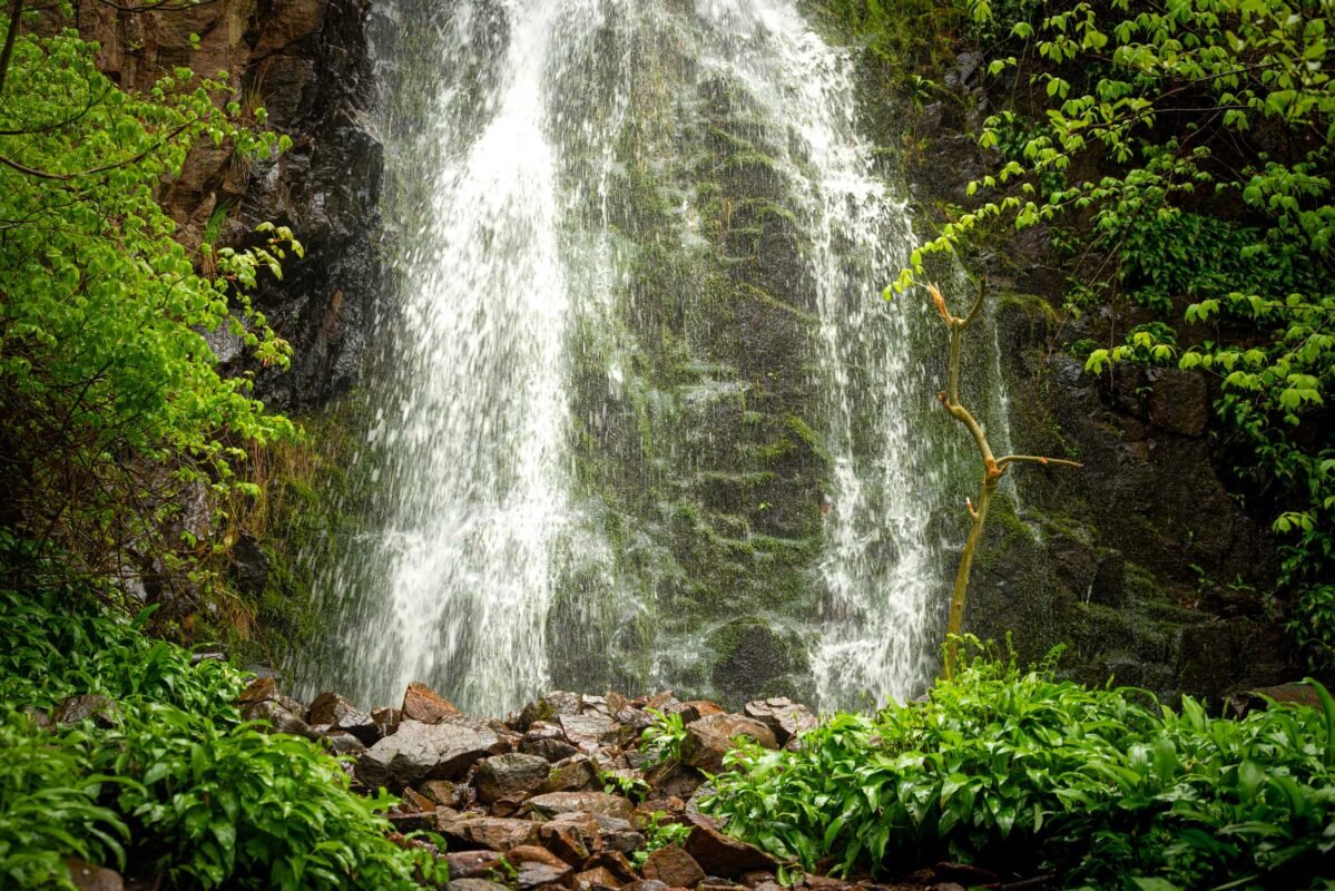
- Pissebækken waterfall – Surprising green oasis
- View of Hammershus – First panoramic viewpoint of the castle
- View of the Hammeren coast – Spectacular coastline with rugged cliffs
- Ruins of Salomon’s Chapel (6.33 km) – Small 13th-century chapel, historic place for herring fishermen
- Opalsøen – Impressive old granite quarry with turquoise water
- And of course the ruins of Hammershus – The main destination, largest medieval fort in Northern Europe
Of course, you can choose a shorter route around the ruins of Hammershus. There are many hiking trails also in the immediate vicinity of Hammershus, it’s a beautiful area. Around Hammershus, several hiking trails run that are part of the larger network of routes on Bornholm.
Other Hiking Options Around Hammershus
- Hammerknuden loop: About 3 hours, past Opalsøen and lighthouse
- Slotslyngen: Short loop through forest and heath (variable lengths possible)
- To Sandvig: About 5 km, moderate, through varied landscape
Best Time to Visit Hammershus
Hammershus is accessible year-round, but the atmosphere differs greatly per season. In summer, the area is livelier and busier, especially around midday.
- May-June: Spring, blooming heather, pleasant weather, less busy than high season
- July-August (high season): All facilities open, most visitors, lively but busier
- September-October: Autumn, beautiful colors, quieter, ideal for photography
- November-April (low season): Often visitor center closed, but ruins freely accessible, very quiet, free parking
For peace and photography, spring and autumn are most interesting. In spring and autumn, the light is softer, the sky more dynamic, and the number of visitors limited. In winter, the landscape can feel raw and empty — impressive, but dependent on weather and wind.
We always choose spring and autumn. Then peace has returned to the island and you have all the space and tranquility to explore and photograph everything. May, June, September and October offer a good balance between accessibility and silence. It’s precisely in these months that the character of Hammershus comes to the fore most strongly.
Staying on Bornholm
Hammershus combines well with a stay in the north of Bornholm. Places like Allinge and Sandvig are nearby and offer a peaceful base. From here, you can easily explore other parts of the island as well. We always choose a vacation home, then we have all the space and peace.
Bornholm is compact, so distances remain short. This makes it possible to return to the same place multiple times a day, depending on light and weather — something Hammershus is particularly worth. From the north, you can also easily reach other highlights such as Christiansø, the harbor towns Gudhjem and Tejn, and the beautiful beaches in the south.
Read more about Christiansø here. And here you can read more about the beautiful beaches on the south side of the island.
Practical Information: Everything You Need to Know
Location and Accessibility
Hammershus is located on the northwest coast of Bornholm, between the towns of Allinge and Sandvig. The ruin is easily accessible by car, bicycle, or on foot from both towns.
Address for navigation: Slotslyngvej 9, 3770 Allinge
| From Rønne | 30 km (35-40 minutes drive) |
| From Gudhjem | 15 km (20 minutes drive) |
| From Allinge | 3 km (10 min drive / 40 min walk) |
| Public transport | Bus lines 2 and 8 from Sandvig |
Parking at Hammershus
| Parking lot P2 | DKK 35 for 6 hours |
| Payment period | Palm Sunday through week 42 (autumn break) |
| Payment | Parking machine (license plate, coins/credit card) |
| Parking lot P1 | Buses and disabled parking only |
| Free parking | November-March (off-season) |
Alternative: Park your car somewhere in Vang, for example, and walk to Hammershus. It’s a beautiful coastal route that’s approximately 7 km long.
Access and Costs
| Free access | Paid |
| • Ruins (year-round) • Visitor center • Exhibition | • Parking: DKK 35 (season) • Guided tours: variable • Café and shop: optional |
Time Needed for Visit
- Minimum: 1-1.5 hours for visiting the ruins
- Recommended: 2-3 hours including visitor center and walk
- With extended hike: 3-5 hours (for example, the coastal route from Vang)
- Photography: Plan at least 2-3 hours, ideal at sunset
Facilities
- Visitor center: Exhibition about the history of Hammershus
- Café Brohuset: Traditional Danish smørrebrød, fish dishes, drinks
- Shop: Souvenirs and local products
- Toilets: Available at the visitor center
- Accessibility: Visitor center wheelchair accessible, ruins partially accessible
What to Bring
| • Good hiking shoes • Windbreaker • Camera | • Water and snacks • Binoculars (optional) • Warm clothing (winter) |
Frequently Asked Questions About Hammershus
How much does a visit to Hammershus cost?
Access to the Hammershus ruins and visitor center is completely free. You only pay for parking during high season: DKK 35 for 6 hours at parking lot P2 (from Palm Sunday to autumn break week 42). Outside the season, parking is free. The café and shop are optional.
How long do you need for Hammershus?
For a visit to just the ruins, we estimate 1-1.5 hours. If you also want to see the visitor center and take a short walk, then 2-3 hours is recommended. For extended hikes like the coastal route from Vang or photography at sunset, plan 3-5 hours.
Is Hammershus suitable for children and families?
Yes, Hammershus is suitable for families, but keep in mind the uneven terrain and elevation changes. Children often find it adventurous to walk between the old walls. Note: climbing on the walls is not allowed for safety and monument preservation reasons. The visitor center is fully accessible and child-friendly with a café that also serves children’s meals.
Can you visit Hammershus in winter?
Yes, the ruins are freely accessible year-round, even when the visitor center is closed (usually November-March). In winter, it’s often very quiet and parking is free. It can be cold and windy though, so dress warmly. The winter months offer a raw and impressive landscape, ideal for photographers who appreciate dramatic atmospheres.
Are guided tours available at Hammershus?
Yes, during the season (especially in summer, Easter and autumn break), Bornholms Middelaldercentrum organizes guided tours at Hammershus. Tours are usually in Danish, but in July and August there are also English and German-language tours on certain dates. You can book tickets online via the Bornholms Middelaldercentrum website. A guided tour lasts approximately 1 hour.
What is the most beautiful hiking route to Hammershus?
The most beautiful hiking route is the coastal route from Vang to Hammershus (approximately 7 km one way). This route leads past spectacular cliffs, the Pissebækken waterfall, the Mulekleven bird rocks, and the remarkable camel and lion head rock formations. It’s a challenging route but with unforgettable views. For an easier alternative, you can walk from Allinge or Sandvig (both approximately 3 km).
In Conclusion
Hammershus is not a place you “check off”. It’s a landscape that gives you space to look, walk and wait. The combination of ruin, sea and light makes each visit different.
For me, this is one of those locations where history doesn’t tell a story, but forms a background. You are there, you move through it — and that is enough.
In my photobook Bornholm – Pearl of the Baltic Sea, you can get a good impression of this beautiful island through many beautiful photos. Most locations also have QR codes so you have direct access to additional location information.
Useful Links and Information
- Hammershus Visitor Center – bornholm.info/hammershus-visitorcenter
- Bornholms Middelaldercentrum – bornholmsmiddelaldercenter.dk
- Visit Bornholm – bornholm.info
- Ferry Bornholm – bornholmslinjen.com
- Hiking Routes Bornholm – bornholm.info/hiking
- Accommodation Bornholm – bornholm.info/accommodation
- Opalsøen
- Most beautifull hiking trail on Bornholm
Locations on the Map
Gallery
Pictures say more than words: