
About this place
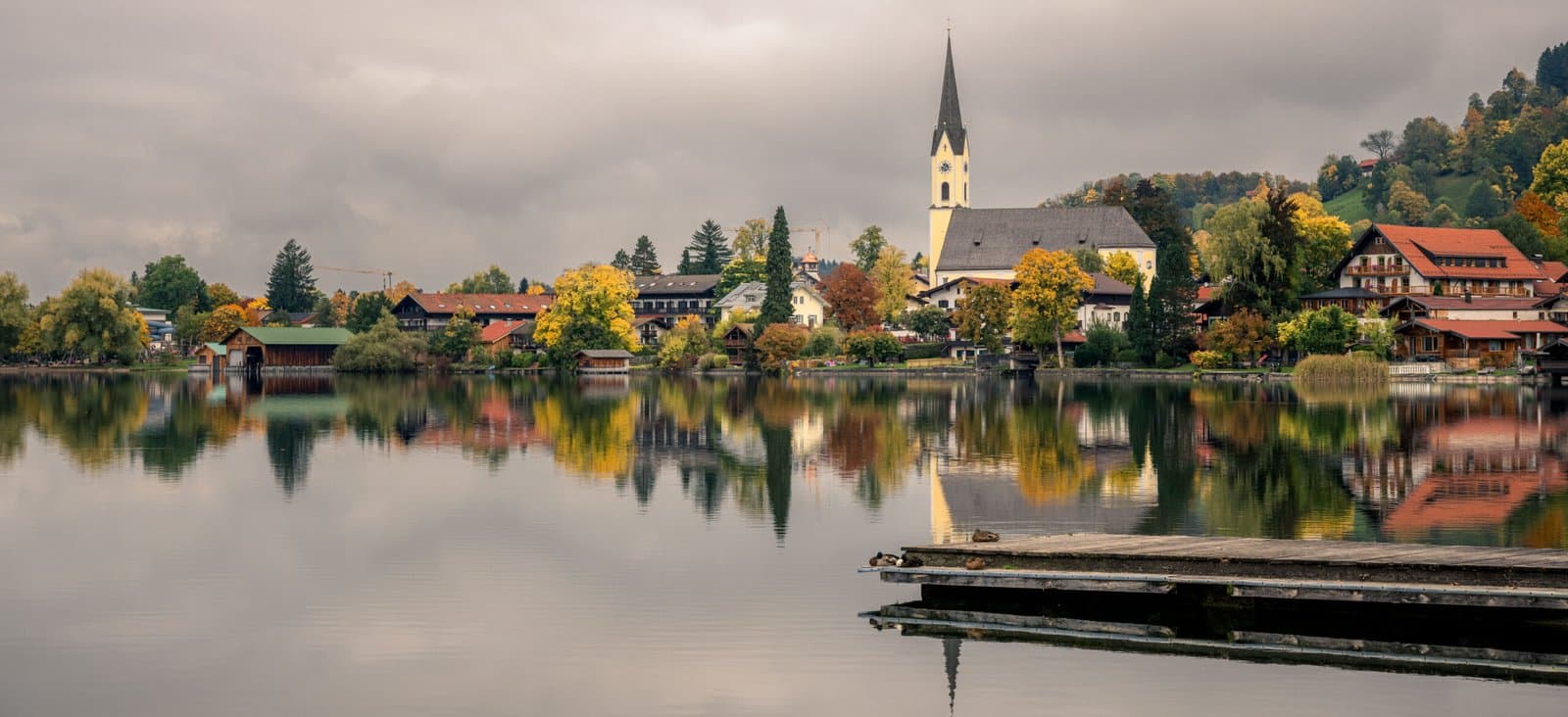
Schliersee lies in the heart of the Bavarian Alps, about fifty kilometres south of Munich. The lake and its surrounding mountains form one of the most picturesque regions in southern Germany — a place where alpine traditions, mountain life, and quiet nature come together. The village of Schliersee, located on the western shore, has retained its authentic Bavarian character, with wooden chalets, painted façades, and cosy inns serving regional food.
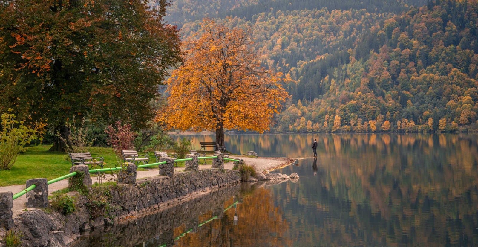
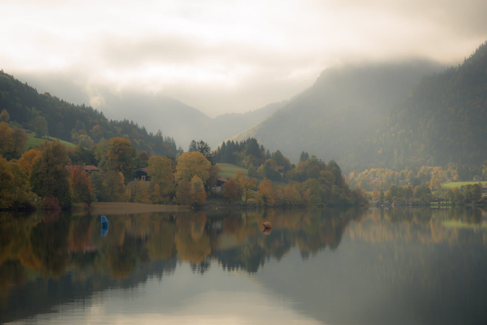
In autumn, the landscape around the lake transforms into a vivid tapestry of colour. The slopes of the Brecherspitz and the neighbouring peaks glow with deep reds and golds as the deciduous forests prepare for winter. Mist often rises from the lake in the early morning, drifting across the still surface and catching the first rays of sun. On calm days, the reflections of the trees and mountains create perfect mirror images that change subtly as the light moves across the valley.
The area around Schliersee offers a blend of easy access and true alpine feeling. Within minutes, you can leave the village behind and find yourself on forest paths, quiet meadows, and panoramic viewpoints. Despite its popularity among Munich day-trippers, it remains peaceful in the shoulder season, making it an ideal base for exploring the autumn landscapes of Upper Bavaria.
Best time to visit:
From late September to late October, when the forests around the lake reach their most vibrant colours and temperatures remain comfortable for hiking. Early mornings and calm days bring mist and clear reflections that are perfect for photography.
Practical tips:
Schliersee is easily reached by train from Munich (about one hour) or by car via the A8 motorway. The village has a small but pleasant lakeside promenade with cafés, bakeries, and local shops. For elevated views, take the cable car or hike to Schliersbergalm above the lake. Mornings can be cold, so bring gloves and a warm jacket, even when the days are mild.
Golden Hour & Blue Hour
00:57
Morning Astronomical twilight Start
02:02
Morning Nautical twilight Start
02:51
Morning Civil twilight Start
02:26
Morning Blue hour Start
03:29
Morning Sunrise Start
03:33
Morning Golden hour Start
18:05
Evening Golden hour End
18:51
Evening Sunset Start
19:54
Evening Blue hour End
19:29
Evening Civil twilight End
20:19
Evening Nautical twilight End
21:23
Evening Astronomical twilight End
Times calculated from coordinates using suncalc.
Current weather

17°C
broken clouds
- Feels like
- 17°C
- Humidity
- 67%
- Wind speed
- 1.3 m/s
- Wind direction
- NE (50°)
- Sunrise
- 03:28
- Sunset
- 18:50
Hourly forecast
- Feels like:
- 15°C
- Humidity:
- 71%
- Wind speed:
- 2 (Light breeze)
- Wind direction:
- S
- Cloud cover:
- 88%
- Dew point:
- 10.3°C
Photography tips
Hiking tips
Routes
Hikes & rides from here
Schliersee View – round trip from Schliersee
- Distance
- 8.5 km
- Ascent
- 267 m
- Descent
- 269 m
- Duration
- 2h 40m
From the village of [schliersee], this loop pulls you gently upward through a landscape that reveals itself little by little. The elevation gain is modest — less than three hundred metres — but the route has character. Forest paths alternate with open stretches where the Bavarian Alps spread out in full width, the lake below you like a mirror set between the hills. The terrain is easy underfoot: partly surfaced paths, partly narrow tracks through the trees, nowhere technically demanding. For a seasoned walker this is a morning well spent; those who move at an easier pace will find a rhythm here that suits looking and listening.
What makes this route special is the way [schliersee] — both the village and the lake — keeps returning as a point of reference. Halfway up the climb you turn around and see the water lying in its bowl of mountains, surrounded by the characteristically dark-green flanks of the Bavarian foothills. That view calls for a moment of stillness. Not because it overwhelms, but because it feels exactly right — the kind of outlook that confirms why you set out in the first place. The return descent is gentle, giving the legs a rest as the surroundings shift from high and open to enclosed and forested.
This is a route for those who have nothing to prove. It suits a quieter day, a camera bag that earns its keep, or a first acquaintance with walking in this part of Germany. The region around Schliersee lies fifty kilometres from Munich, but feels further away than that — stiller, with more air. Two hours and forty minutes is an average, but the path invites you to go slower than that.
Josefsthal Waterfalls – Josefsthaler Waterfall loop from Schliersee
- Distance
- 15.7 km
- Ascent
- 177 m
- Descent
- 181 m
- Duration
- 4h 17m
This loop from Schliersee is a route that asks something of you — not so much in elevation, but in length and character. Just over fifteen kilometres through varied terrain, with forest paths that can be wet and muddy, roots that demand attention, and stretches that slow your pace in a pleasing way. It is a walk for those who are in no hurry to arrive. The landscape around [schliersee] reveals itself gradually: first the village edge, then forest, then the soft roll of the Bavarian foothills drawing themselves against the sky. The lake itself appears now and then along the way — a strip of blue between the trees, a reflection that surfaces briefly and then disappears again.
The highlight of the route lies tucked inside a narrow forest valley: the [josefsthaler-wasserfalle], a series of small waterfalls carrying the Hachelbach down over mossy stone. There is nothing grand-scale about this place — no dramatic gorge, no thundering sound from afar. That is precisely what makes it worth the detour. The water works quietly, light filters through the canopy, and if you take your time you find yourself suddenly standing inside something that feels almost intimate. For photographers, this is the kind of light that calls for a tripod and patience: shadowed, shifting, with moments when everything comes together at once.
The return leads back toward Schliersee along paths that show the landscape from a different angle. Those accustomed to long days out, and who bring a decent pair of boots, will find here a route that rewards without boasting about it. Southern Germany at its more modest best.
Passes by
Gallery