
About this place
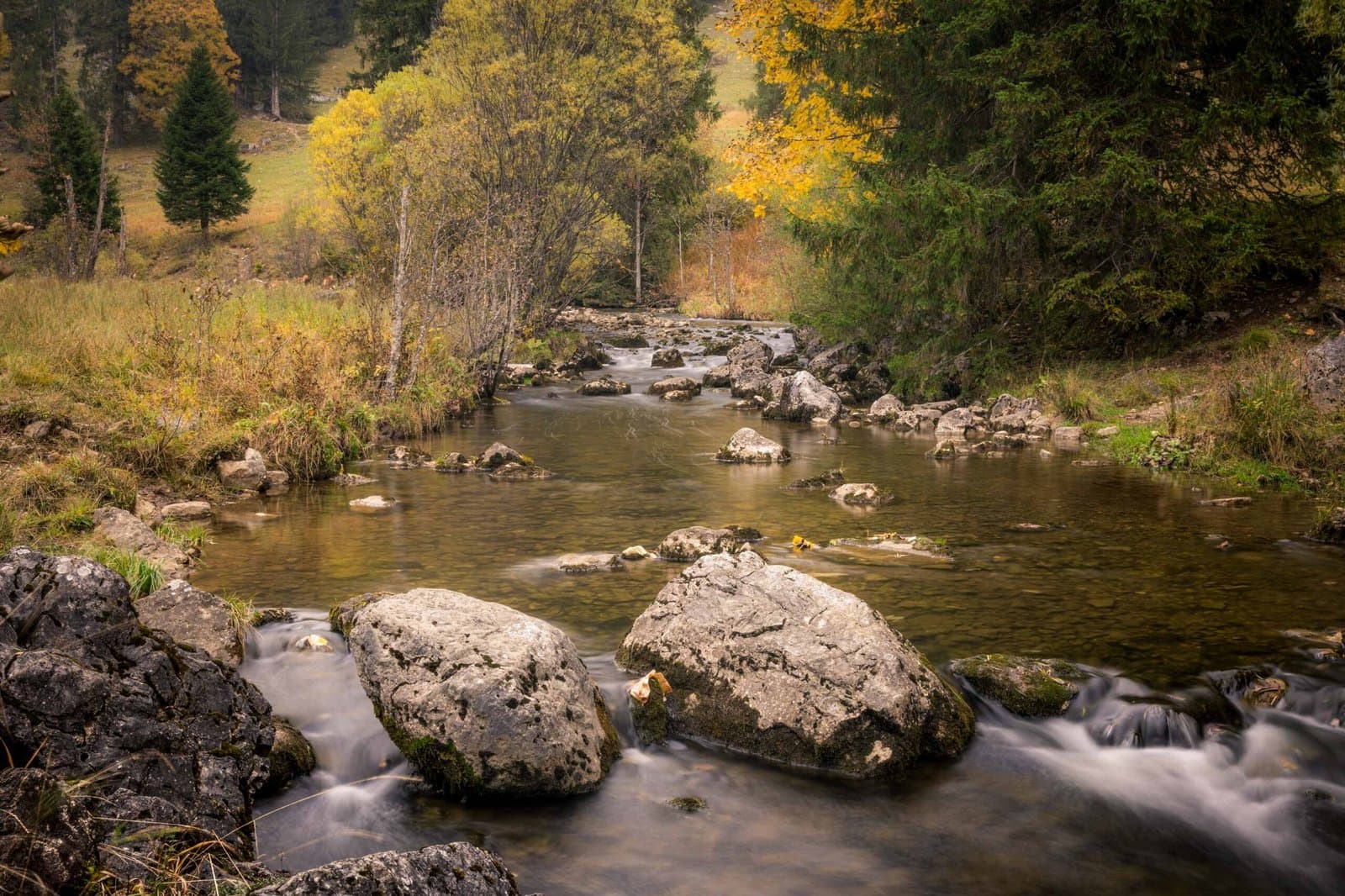
Spitzingsee is a serene mountain lake located about five kilometres south of Schliersee, at an elevation of just over 1,000 metres. Surrounded by forested ridges and alpine meadows, it is one of Bavaria’s most beautiful and accessible high-altitude lakes. The village of Spitzingsee sits on its northern shore, offering a perfect base for exploring the surrounding mountains and valleys.
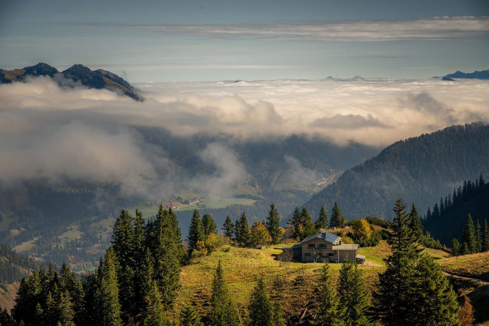
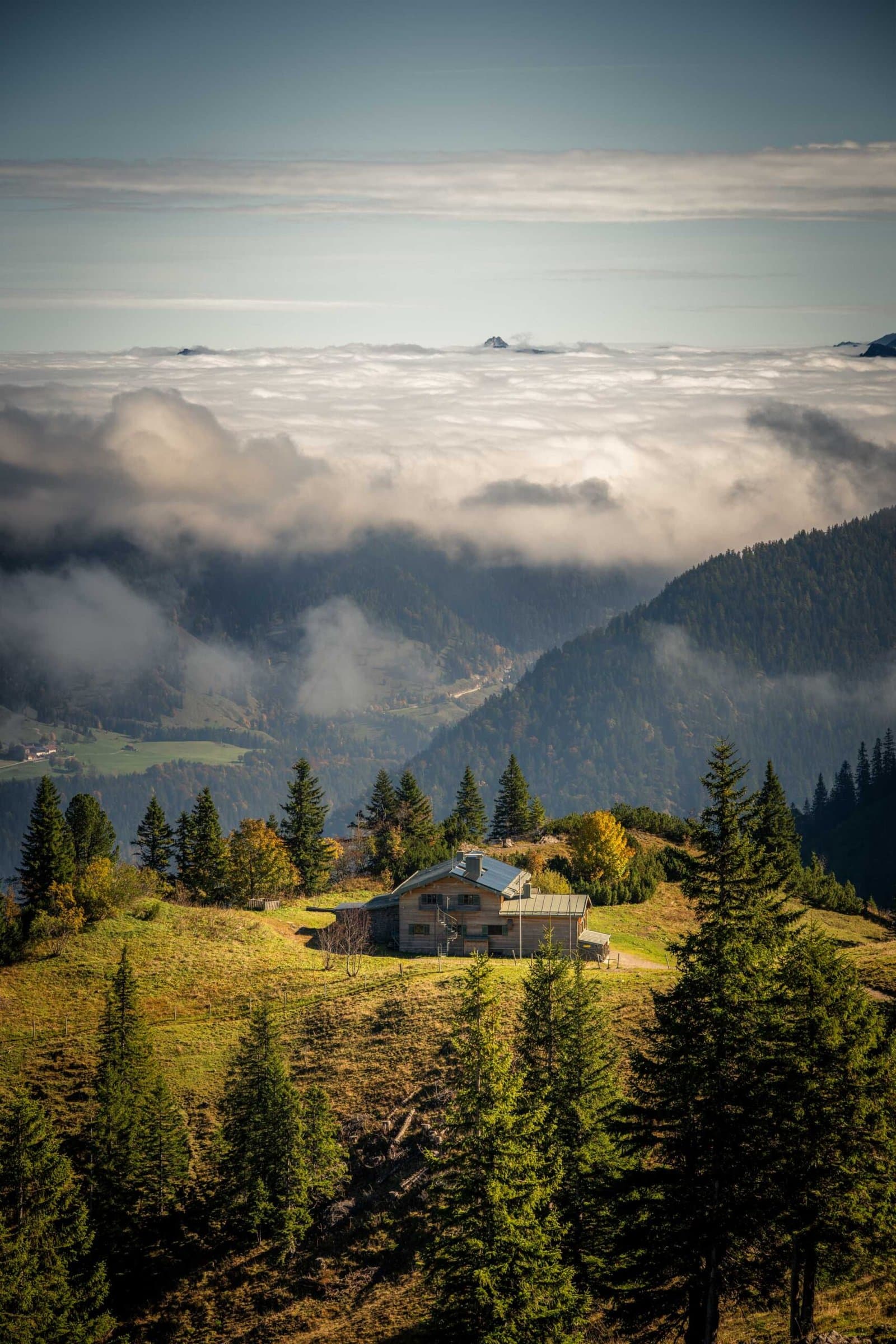
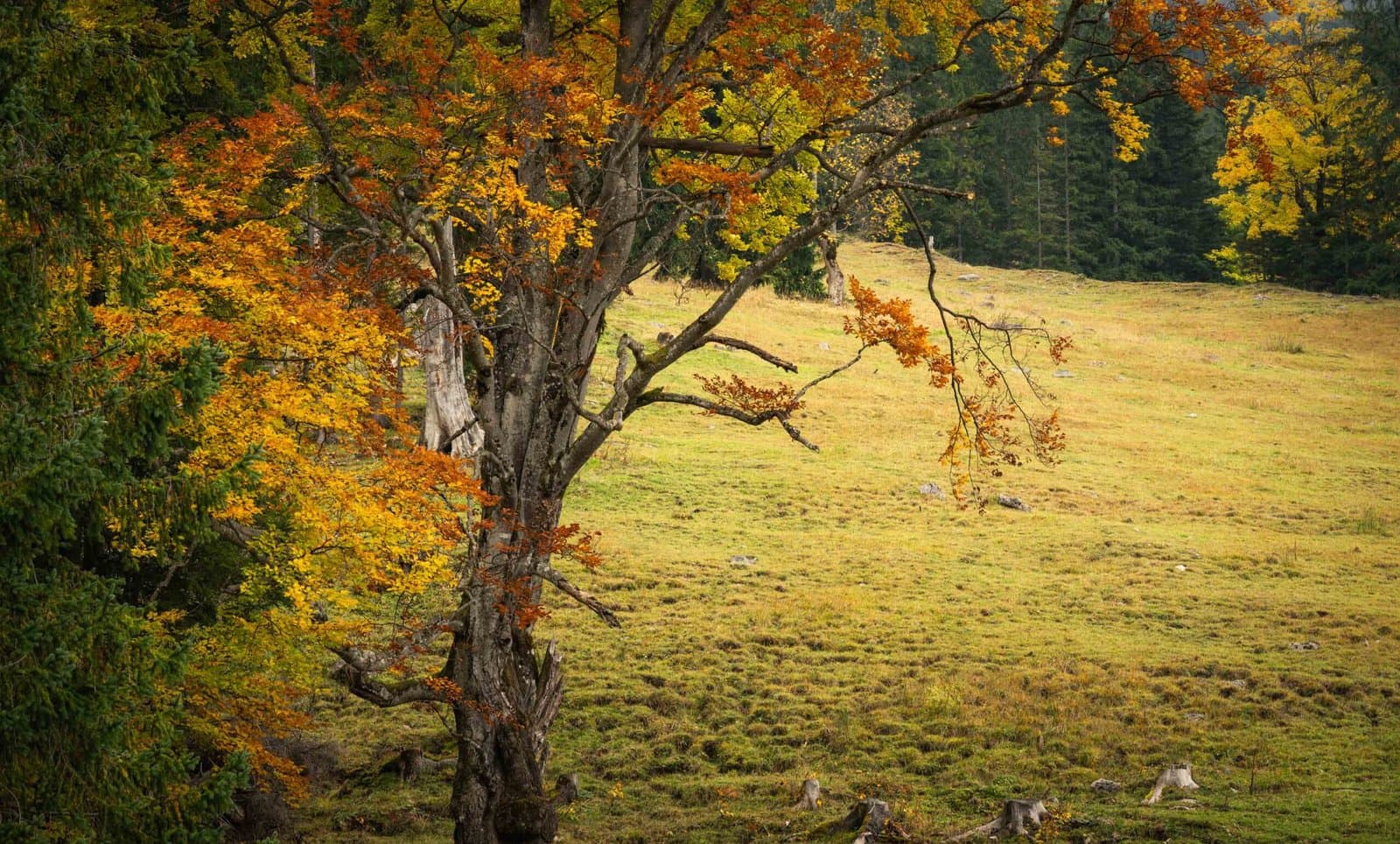
In autumn, the scenery around Spitzingsee transforms into a glowing mosaic of colour. The larch and beech forests on the surrounding slopes turn to shades of gold and copper, while mist lingers over the water in the cool mornings. On calm days, the lake acts as a perfect mirror for the peaks of Brecherspitz and Jägerkamp, creating one of the most photogenic reflections in the Bavarian Alps. The combination of crisp mountain air, vibrant foliage, and quiet trails makes this a true autumn paradise.
The area has a long history as a retreat for nature lovers and mountain hikers from Munich. Despite its popularity in summer, autumn brings a welcome sense of peace — the sound of bells from grazing cows, the scent of pine needles, and the occasional call of a jay echo through the valley. A circular trail follows the shoreline, allowing easy access to quiet spots where you can simply sit and take in the scenery.
Best time to visit:
Late September to mid-October, when the larch and beech trees show their full colour and temperatures remain mild enough for hiking. Early mornings offer mist and still reflections, while late afternoons bring warm light across the lake.
Practical tips:
Spitzingsee is easily reached by car or bus from Schliersee. A large parking area is located near the lake, and several alpine inns and cafés remain open in autumn. Weather can change quickly at this altitude, so pack a light jacket and waterproof footwear. For panoramic views, take the Taubenstein cable car (if running) or hike to one of the nearby peaks.
Golden Hour & Blue Hour
00:58
Morning Astronomical twilight Start
02:02
Morning Nautical twilight Start
02:52
Morning Civil twilight Start
02:27
Morning Blue hour Start
03:29
Morning Sunrise Start
03:33
Morning Golden hour Start
18:05
Evening Golden hour End
18:51
Evening Sunset Start
19:53
Evening Blue hour End
19:28
Evening Civil twilight End
20:18
Evening Nautical twilight End
21:22
Evening Astronomical twilight End
Times calculated from coordinates using suncalc.
Current weather

14°C
overcast clouds
- Feels like
- 13°C
- Humidity
- 52%
- Wind speed
- 2.2 m/s
- Wind direction
- NE (43°)
- Sunrise
- 03:28
- Sunset
- 18:50
Hourly forecast
- Feels like:
- 14°C
- Humidity:
- 59%
- Wind speed:
- 1 (Light air)
- Wind direction:
- NE
- Cloud cover:
- 97%
- Dew point:
- 6.7°C
Photography tips
Hiking tips
An easy 3-kilometre loop circles the lake, ideal for a leisurely walk or morning shoot. For more challenging hikes, ascend Brecherspitz or Jägerkamp for panoramic views of the lake and the surrounding valleys. Trails are well marked, but after rain they can be muddy and slippery, so good hiking shoes are essential.
Routes
Hikes & rides from here
Josefsthaler Waterfall – View of Spitzingsee from Neuhaus
- Distance
- 11.5 km
- Ascent
- 385 m
- Descent
- 384 m
- Duration
- 3h 36m
This route winds through a corner of Upper Bavaria that is quiet enough to allow for genuine looking. We begin at [spitzingsee], a mountain lake at just over a thousand metres elevation that lies almost motionless in the early light — the water dark, the surrounding ridges still half in shadow. The path then draws down into the valley towards Josefsthal, where the terrain descends gradually along forested slopes. The surface alternates between narrow forest trail and broad unpaved track; sturdy walking shoes are welcome, though the route demands no climbing experience. The elevation change is modest enough to maintain a steady pace without rushing past the surroundings.
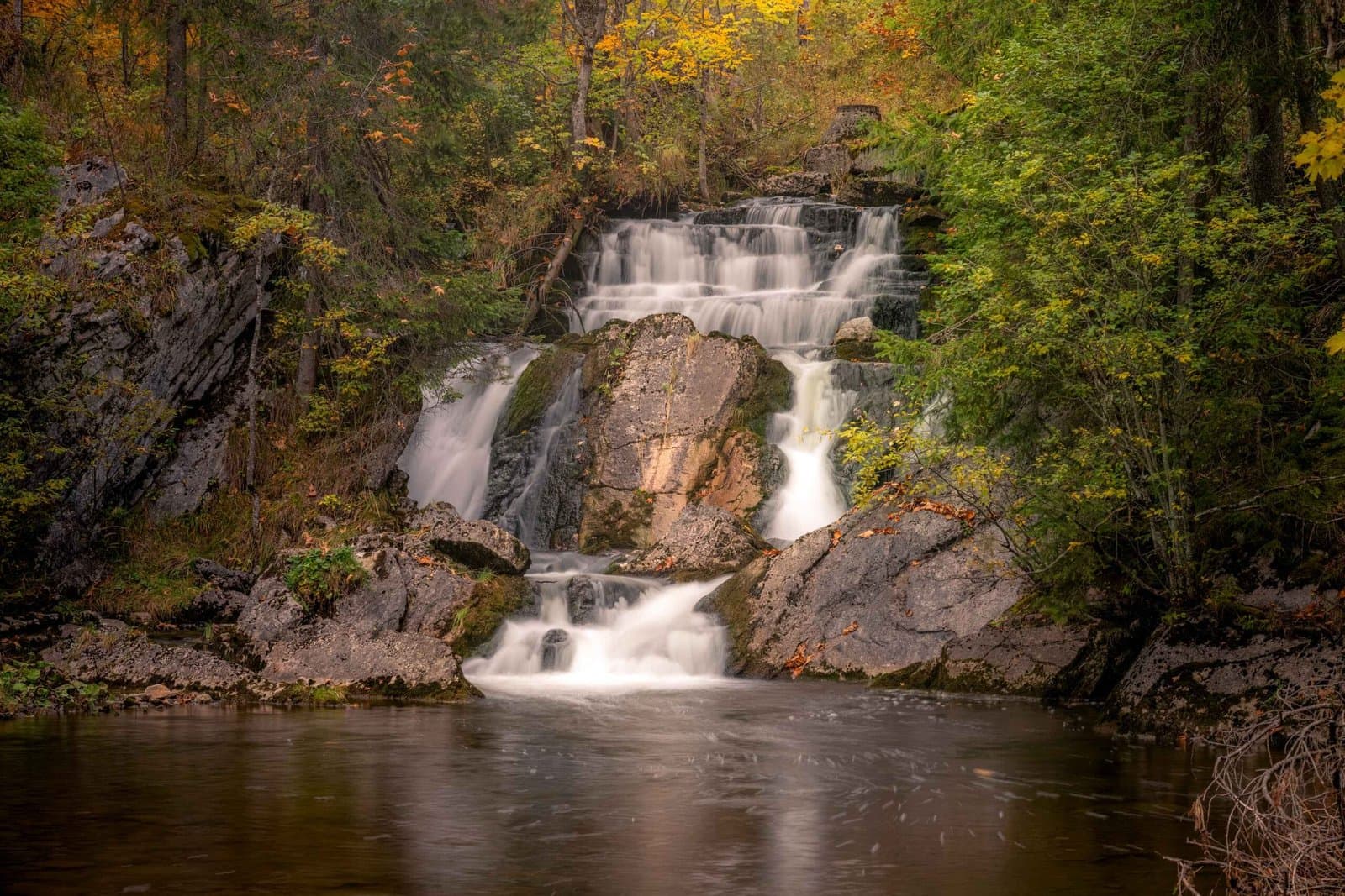
The route's high point, in a literal sense, may well be its lowest: the [josefsthaler-wasserfalle], a series of small waterfalls through which the Hachelbach works its way down over narrow ledges. They lie tucked away in the forest, and that reticent quality is precisely what makes them appealing — no busy car park, no sign telling you what to think. The sound arrives before the sight: water on stone, muffled by the trees around it. This is the kind of place that photographs better in overcast light, when shadows are soft and the water reveals its own texture.
The return leg climbs gradually back up to Neuhaus, from where you look out over the lake that opened the route. The loop is long enough to give the legs something to do, yet compact enough for half a day. Walkers who enjoy variety in landscape — open water, dense forest, an unhurried waterfall — will find exactly that here. Those who also explore by bike will manage the wider stretches well enough, but at heart this is a walking route.
Passes by
Uitzicht op Rotwand – Rotwand Gipfel rondreis vanaf Spitzingsee
- Distance
- 14.1 km
- Ascent
- 747 m
- Descent
- 761 m
- Duration
- 5h 56m
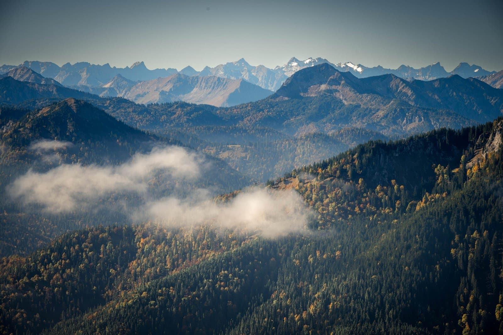
This circular route begins and ends at the [spitzingsee], the quiet mountain lake sitting at just over a thousand metres that immediately gives you a sense of what lies above. The lake itself has something quietly restrained about it — the water dark and still between forested slopes — and it makes a good starting point to catch your breath before the route climbs toward the ridge and the Rotwand. From here the path rises steadily, first through forest and across open alpine meadows, then over rougher ground where the soil turns rockier and the wind finds more purchase. The nearly 750 metres of ascent makes itself felt, not as a wall but as a slow accumulation of altitude that gradually weights your legs.
At the top, the Rotwand Gipfel sits at just over 1,884 metres, and the view that opens up across the Bavarian Alps and the valleys beyond is the kind of panorama that keeps you quiet for a while. The descent brings you back to the [spitzingsee] along a slightly different line, with enough variation in the landscape to round off the walk without it feeling like a repeat. Around six hours in total, with a character that is demanding but not technical — this is a route for people who can walk strongly and aren't put off by some uneven ground, but it requires no specialist equipment. For photography it pays to set out early: the morning light on the lake and the long shadows across the rocky outcrops higher up give the whole outing a different weight than an afternoon start would.
Gallery