
Johan
Contents(22)
- 01Feanwâlden — a spring morning among geese, ducks and a fleeing roe deer
- 02About Feanwâlden and It Bûtefjild
- 03How to get to Feanwâlden
- 04By car
- 05By public transport
- 06Parking near Feanwâlden
- 07History of Feanwâlden
- 08The surroundings of Feanwâlden
- 09It Bûtefjild
- 10Houtwiel
- 11Noardlike Fryske Wâlden
- 12Photography at Feanwâlden
- 13Walking route near Feanwâlden
- 14The Bûtefjild loop — 4.3 km
- 15Best time to visit Feanwâlden
- 16Practical information
- 17Access and costs
- 18Facilities
- 19What to bring
- 20Frequently asked questions
- 21In closing
- 22Useful links
Feanwâlden — a spring morning among geese, ducks and a fleeing roe deer
It is one of those mornings in May when you simply cannot stay at home. The sky above Feanwâlden is clear, the trees are full of fresh green growth and everywhere you can hear the sound of birds that have launched their spring offensive. I know this loop well — I walk it regularly, sometimes several times a week — and yet it surprises me every single time. Today, on 13 May, is no different. Barely a hundred metres into the forest something darts away between the trunks. A roe deer. So close that I am startled by the rustling and the sudden clatter of hooves on the forest floor. In one fluid movement the animal vanishes among the trees, as if it had never been there.
That is precisely what makes this walking loop near Feanwâlden so worthwhile. It is no grand expedition, no adventure that requires hours of driving. It is nature right on the edge of a village — raw, vibrant and full of surprises, even when you have walked the route dozens of times before.

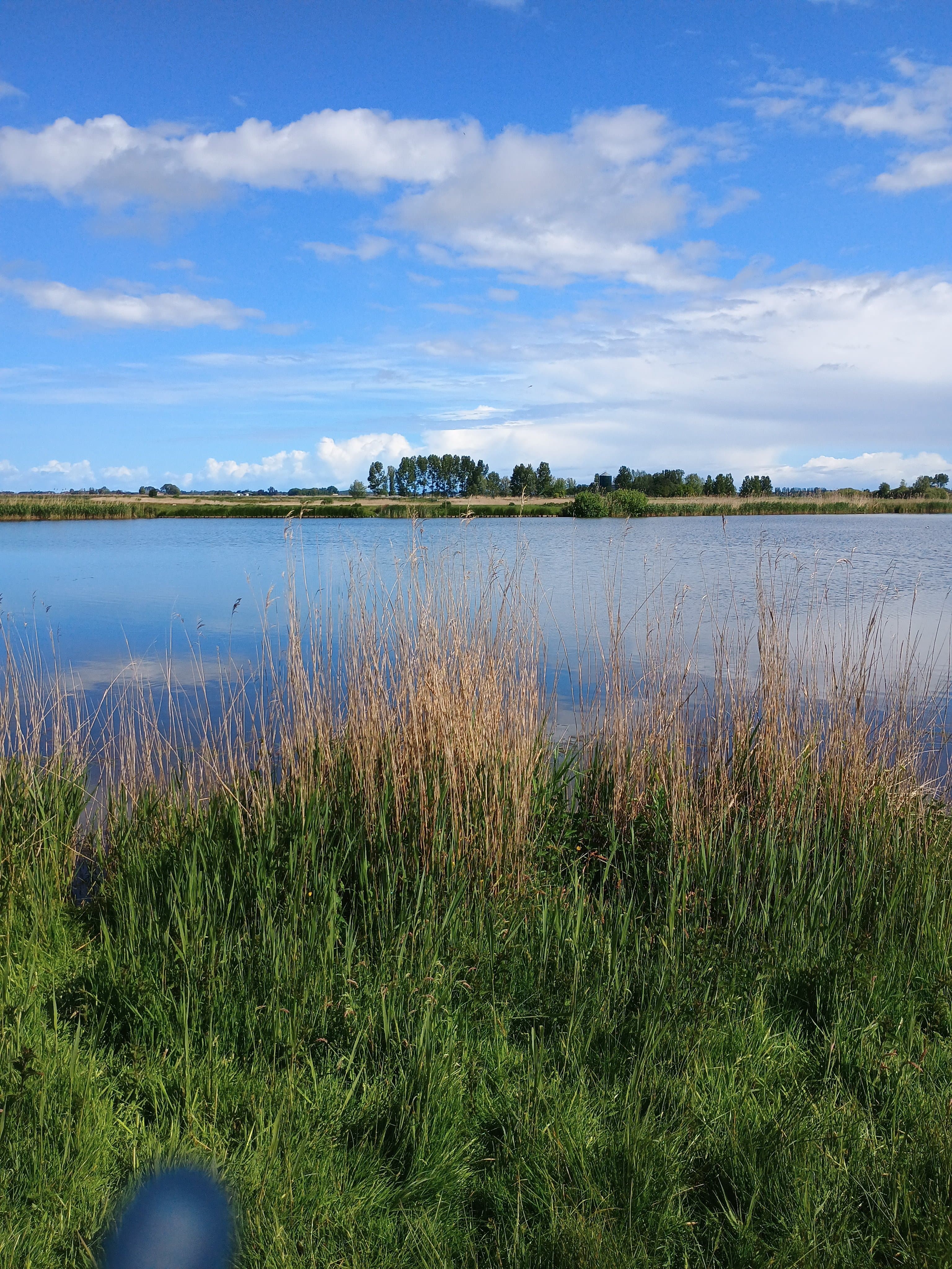
The open landscape of It Bûtefjild near Feanwâlden on a clear spring morning.
About Feanwâlden and It Bûtefjild
Feanwâlden — in Dutch Veenwouden — is a village in the municipality of Dantumadiel in the province of Friesland, situated on a boulder-clay ridge at the edge of the higher-lying Pleistocene grounds. The village has around 3,400 inhabitants and its own train station, making it easily accessible for walkers from outside the region. What makes the village special is its direct position alongside the nature reserve It Bûtefjild: 322 hectares of nature that literally begins where the built-up area ends.
It Bûtefjild is a managed nature reserve belonging to It Fryske Gea, the Frisian nature conservation organisation. The area combines wet grasslands, reed beds and rough vegetation, open water, alder carr and willow scrub. This variety makes it a rich habitat for water birds, dragonflies, the moor frog and mammals such as roe deer. In spring the area is at its most beautiful: young geese and ducks find their way along the banks, and the foliage of the alders and willows turns every reflection in the water green.
Feanwâlden · 13 May
Hike
4.3 km
Distance
↑ 10 m
Ascent
1 h 24 min
Duration
Location: Feanwâlden (Veenwouden), municipality of Dantumadiel, Friesland
GPS coordinates starting point: 53.2650° N, 5.9850° E (near Feanwâlden station)
Area of It Bûtefjild: 322 hectares
Best season: Spring (April–June) for young birds and blossom; autumn for colours
Admission: Free
Difficulty: Easy — suitable for all ages, including families with children
Route length: approx. 4.3 km
Estimated walking time: approx. 1 hour 15 minutes
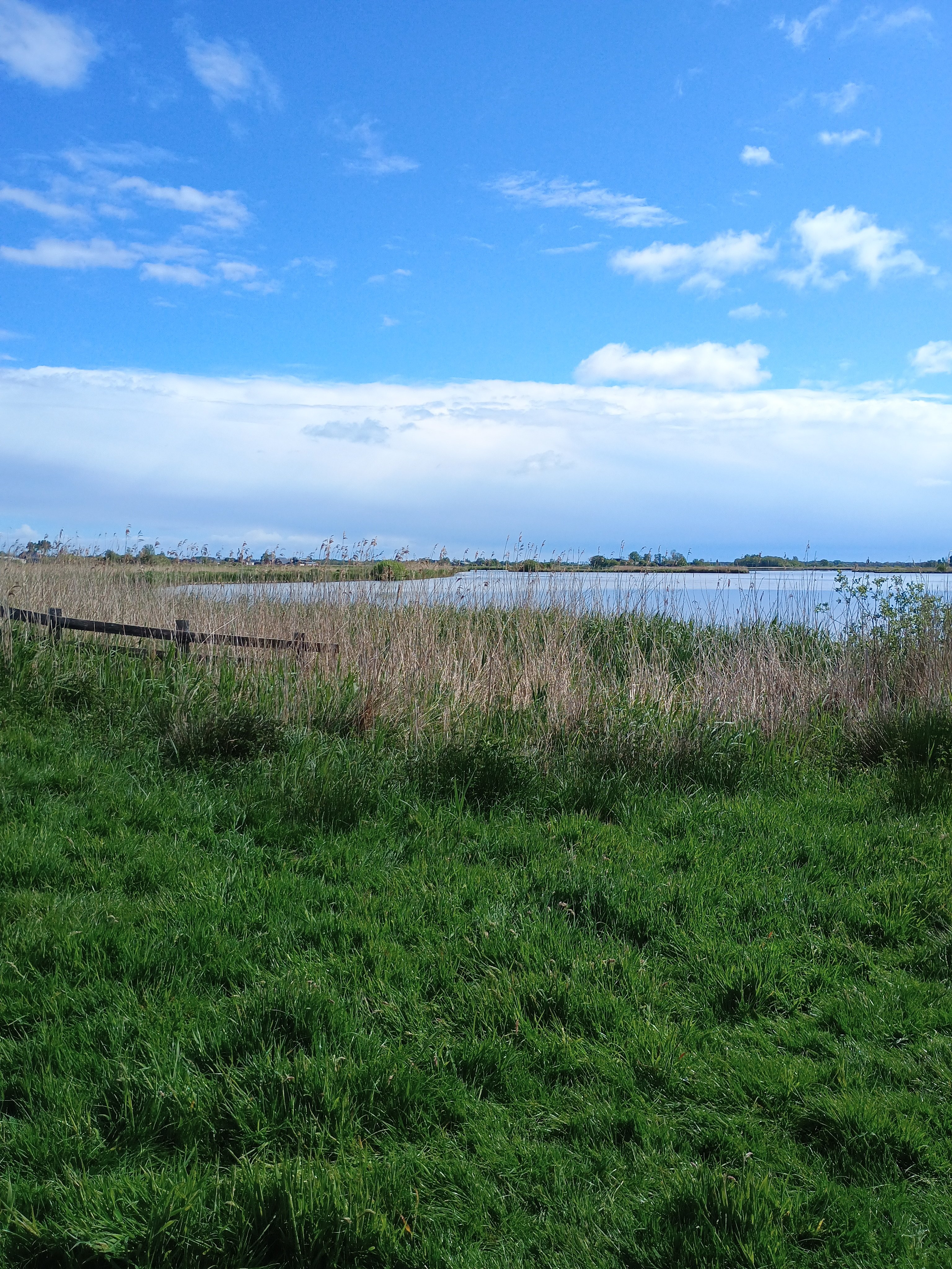
Reed-lined banks and open water are the hallmark of It Bûtefjild — ideal habitat for water birds.
How to get to Feanwâlden
By car
Feanwâlden is located in the north-east of Friesland and is easily accessible via the A7 and A31. From the major cities the distances are as follows:
From Amsterdam: approx. 150 km, drive roughly 1 hour 45 minutes via the A7 towards Groningen, exit Drachten, then via the N356.
From Rotterdam: approx. 240 km, drive roughly 2 hours 30 minutes via the A10, A7 or A1/A6 towards Friesland.
From Utrecht: approx. 190 km, drive roughly 2 hours via the A27 and A6 towards Leeuwarden, then via Dokkum.
By public transport
Feanwâlden has its own NS train station on the Leeuwarden–Groningen line. From Amsterdam Centraal the journey takes approximately 2 hours and 6 minutes, with a change at Leeuwarden or Groningen. The walking route starts within walking distance of the station — you are in the countryside in less than five minutes.
Parking near Feanwâlden
Right next to the station there is a Tourist Transfer Point (TOP) managed by Recreatieschap Marrekrite. Parking here is free, less than 50 metres from the bus and train station. There is also a bicycle shelter and the option to hire a bike. Those arriving by car can start their day without any parking hassle — a rare luxury (verified May 2025).

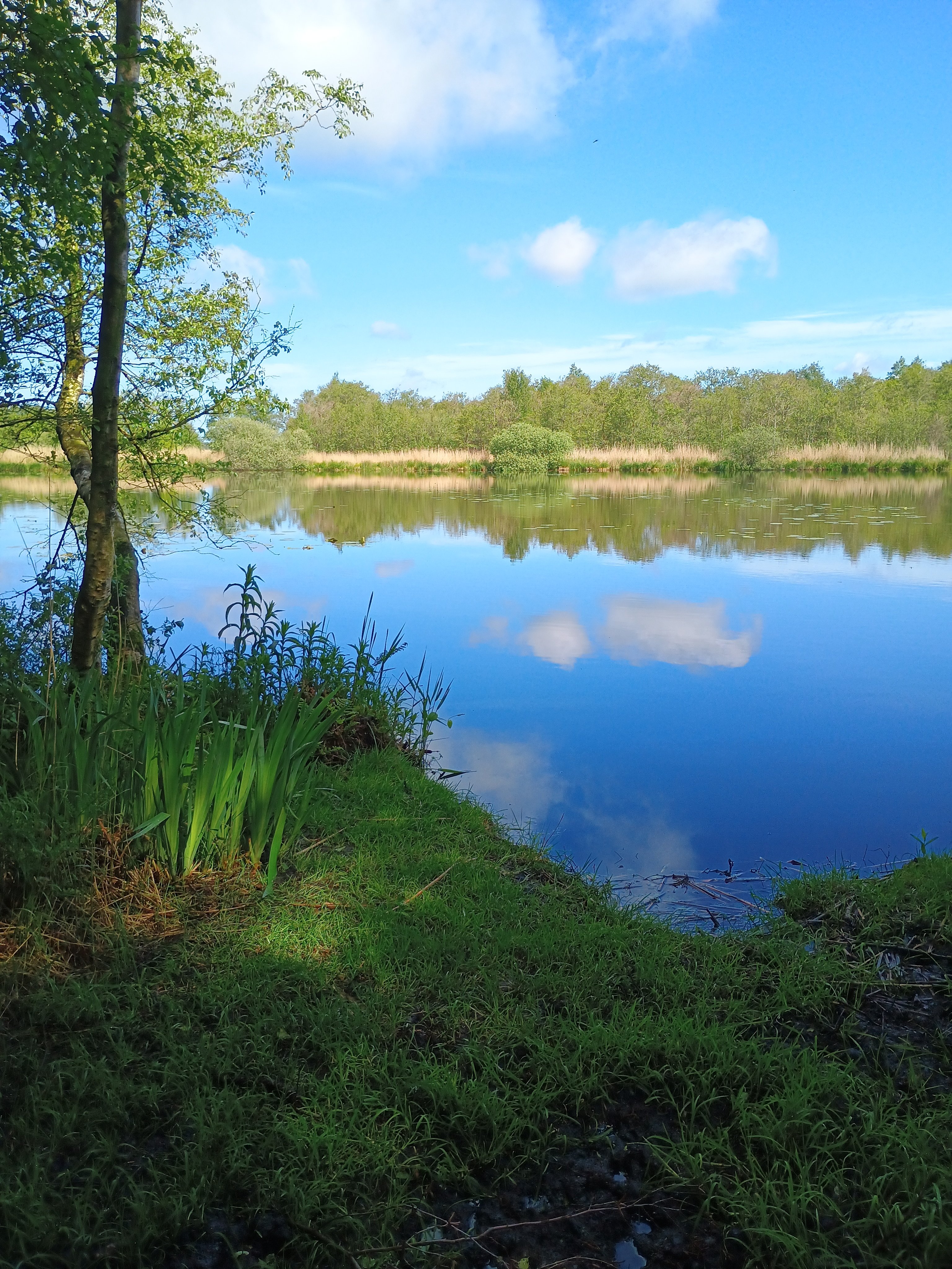
The forest section of the route turns bright green with fresh foliage in May.
History of Feanwâlden
The name Feanwâlden — literally "peat forests" — reveals the origins of this part of Friesland. The village arose on a boulder-clay ridge at the edge of the peat area, a landscape type that has shaped the character of this region for centuries. In the fourteenth century, the settlements of Sint-Johanneswâld and neighbouring hamlets stood here, gradually merging into the present-day village.
The surrounding land was largely peat bog in the Middle Ages, which was reclaimed and dug away by generations of farmers. This peat extraction left deep marks on the landscape: the pools, ditches and wet hollows you now see in It Bûtefjild are largely the result of centuries of peat cutting. What was once a source of fuel is now a living nature reserve — managed by It Fryske Gea, which actively restores and protects the area.

The meadows around Feanwâlden are a reminder of the agricultural past of this peat-land region.
The surroundings of Feanwâlden
It Bûtefjild
The central nature reserve around Feanwâlden is It Bûtefjild, which has a total of 16 kilometres of walking paths. The various sub-areas — including the Sippen-finnen with open water and reed lands — are within walking distance of one another and are all freely accessible. Altogether the area offers several circular walks of varying lengths.
Houtwiel
Within walking distance of It Bûtefjild lies the Houtwiel, a small lake that also forms part of the walking network around Feanwâlden. It is a quiet spot, well suited to birdwatchers looking for water birds in a more tranquil setting than the reed banks of It Bûtefjild.
Noardlike Fryske Wâlden
The wider landscape area is called the Noardlike Fryske Wâlden — the Northern Frisian Woodlands. This coulisse landscape of alder hedgerows, earthen banks and woodland plots is characteristic of the Frisian interior and is on the UNESCO World Heritage Tentative List. Feanwâlden is an excellent base for exploring this type of landscape, by bicycle as well.

Young ducks search for food along the ditch banks — in May they are everywhere.
Photography at Feanwâlden
It Bûtefjild is an area that lends itself well to nature photography, precisely because it is so compact and nature comes so close. The combination of open water, reed-lined banks, meadows and woodland edges offers multiple types of light and compositional possibilities within a single walk.
Best light: Early in the morning, shortly after sunrise, the light along the water features is at its softest and most diffuse. In May the sun rises early and climbs quickly, so for golden light you need to be on location before 7:30. In overcast conditions the light works all day — ideal for close-ups of aquatic plants and birds without harsh shadows.
Best spots: The transition from meadow to water at the Sippen-finnen produces beautiful mirror reflections when it is calm. The woodland edges are well suited to backlit shots of fresh spring foliage in May. Markers 3 and 7 along the route offer open sightlines across the meadow where geese and ducks graze.
Focal lengths: For birds you need at least 300–400 mm; the animals allow you to get reasonably close but remain alert. For landscapes a standard 24–70 mm works perfectly. A macro lens is worthwhile if you want to capture the flowering of aquatic plants and bankside vegetation.
What to avoid: Do not leave the path towards the reed banks — the ground is marshy and you will disturb nesting birds. Do not photograph roe deer with flash; the animal is already startled enough by you.
Young greylag geese are a fixture of the Feanwâlden landscape in May.
Flowering plants in the meadows add colour to the landscape — a rewarding subject for the macro lens.
Walking route near Feanwâlden
The Bûtefjild loop — 4.3 km
The route begins at Feanwâlden station, at Marker 1, and leads you westward into the open polder landscape. You soon notice that this is no dull, monotonous stroll: within the first few hundred metres meadow, ditch bank and woodland edge alternate in quick succession. The grass stands tall, the air smells of wet earth and somewhere in the distance comes the cackling of greylag geese.
At Marker 2 you turn onto a narrower path that cuts along the first woodland edge. This is where the forest section of the route begins, where alders and willows form a dense canopy over the path. On 13 May the leaves are still fresh green and the light filtering through the crowns casts a broken pattern on the ground. It is here that I encounter the roe deer — at Marker 3, just as I glance down to step around a muddy patch. The animal stands still, looks at me for a fraction of a second, and then it is gone. Branches crack. Silence. My heartbeat briefly joins in.

The forest path at Marker 3 — this is exactly where the roe deer appeared, barely ten metres away.
After the forest section the route opens up at Marker 4 into a more expansive meadow area, criss-crossed by ditches. The young geese I see here are already fairly large for May — brown youngsters that barely resemble the grey adults. They graze undisturbed along the ditch bank, just a few metres from the path. A pair of ducks draws an inquisitive wake through the still water of a wide ditch.
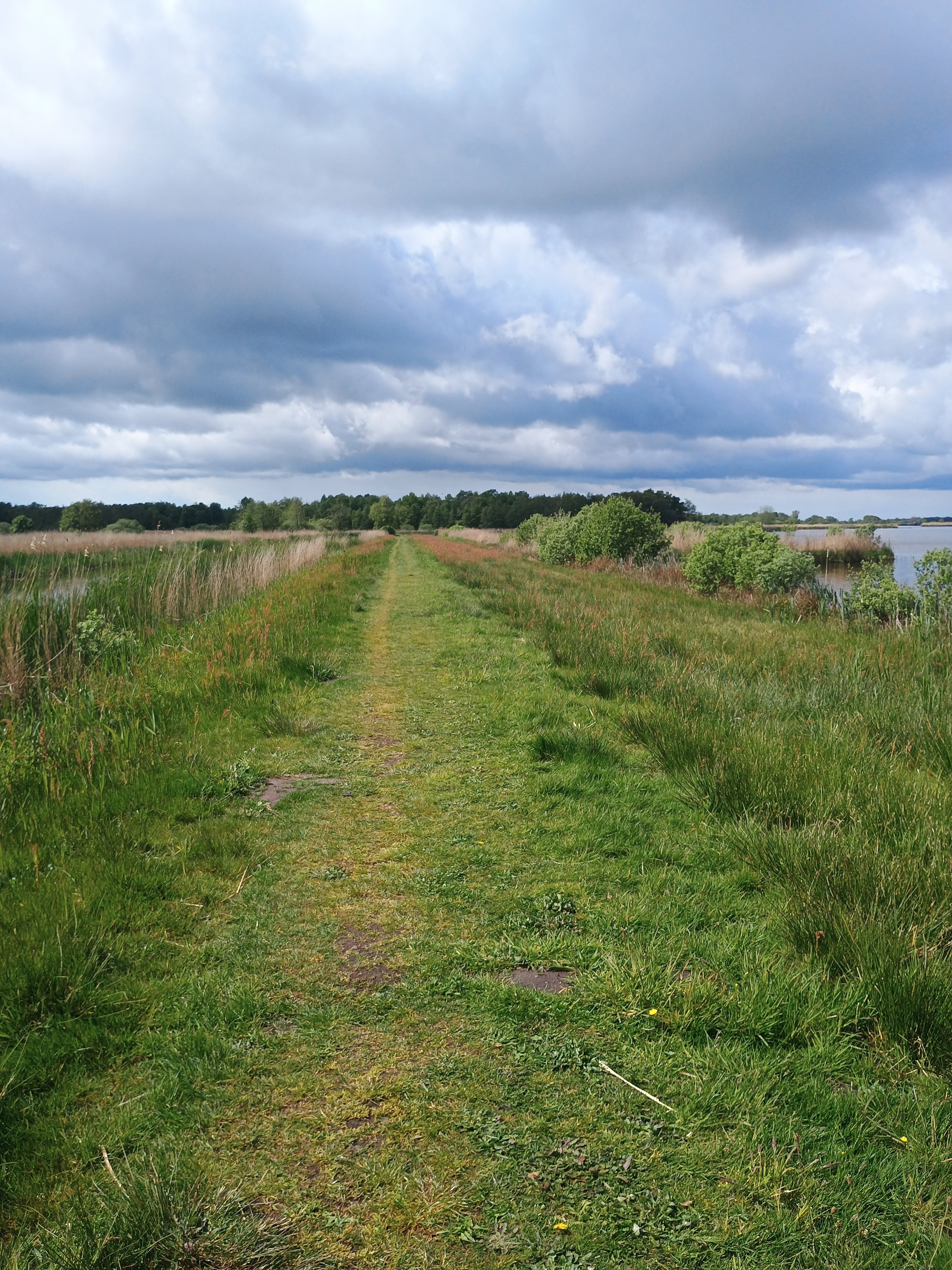
Markers 5 and 6 mark the transition to a more open part of the area, where you have an unobstructed view across the landscape. This is one of the finest spots on the route: you can see far, the sky is vast, and when it is calm the rows of trees are reflected in the ditches. At Marker 7 the route turns and the return leg begins along the southern edge of the area.

The open central section of the route at Marker 5 — a big sky, far-reaching views, Frisian landscape at its finest.
The route continues via Markers 8 and 9, alongside a strip of alder carr that screens you from the surrounding agricultural plots. The path is narrow here and can be somewhat muddy after rain, but is perfectly walkable in ordinary walking shoes. At Marker 10 you reach a spot where two watercourses meet — a quiet corner that is always good for birds.
Markers 11 and 12 lead you along the northern edge of the area back towards the village. The path becomes slightly wider here and the surroundings more open. At Marker 13 you pass a plot of rough vegetation that fills with reeds and marsh plants in summer. Now, in May, the first reed shoots are barely a decimetre tall — the season has only just begun.

The reed banks at Marker 13 are still sparse in May, but grow dense during the summer months.
At Markers 14 and 15 the final stretch of the route begins, running via a dyke and a cycle path along the edge of the village. Marker 16 is a junction with a narrower woodland path that allows a small detour for those with a little extra time. Marker 17, the endpoint, brings you back to the station — and to your car or train, depending on how you arrived.
What makes the route so enjoyable: there is not a single stretch that gives you the feeling you are seeing the same surroundings twice. Meadow, water, forest — the three alternate constantly, and in spring nature does the rest.

The final stretch of the route along the edge of the village — a peaceful, leafy conclusion.
Best time to visit Feanwâlden
Spring (April–June) is the highlight. The birds are nesting, the young have just hatched, the foliage is fresh and the light is soft. Roe deer are active in May and June and come relatively close to the path. The meadows are full of flowering plants. This is the period for those who want to get the most out of the area.
Summer (July–August) the area is lushly green but sometimes less dynamic in terms of fauna. The reeds are at full height and block much of the ditch-bank view. The route is pleasant to walk, though mosquitoes can be a factor in calm weather along the water features.
Autumn (September–November) is the second highlight for photographers: the alders and willows turn yellow and brown, morning mists hang low over the meadows and migrating birds make brief stops along the banks. October is the most beautiful autumn month in this area.
Winter (December–March) is quiet and austere. In frost the ditches and pools fall silent under ice, giving the area a completely different character. After a hard night you may come across skaters on the larger stretches of water. The bare trees offer a long view into the forest — when the leaves are out you often see less of the woodland birds in summer than in February.

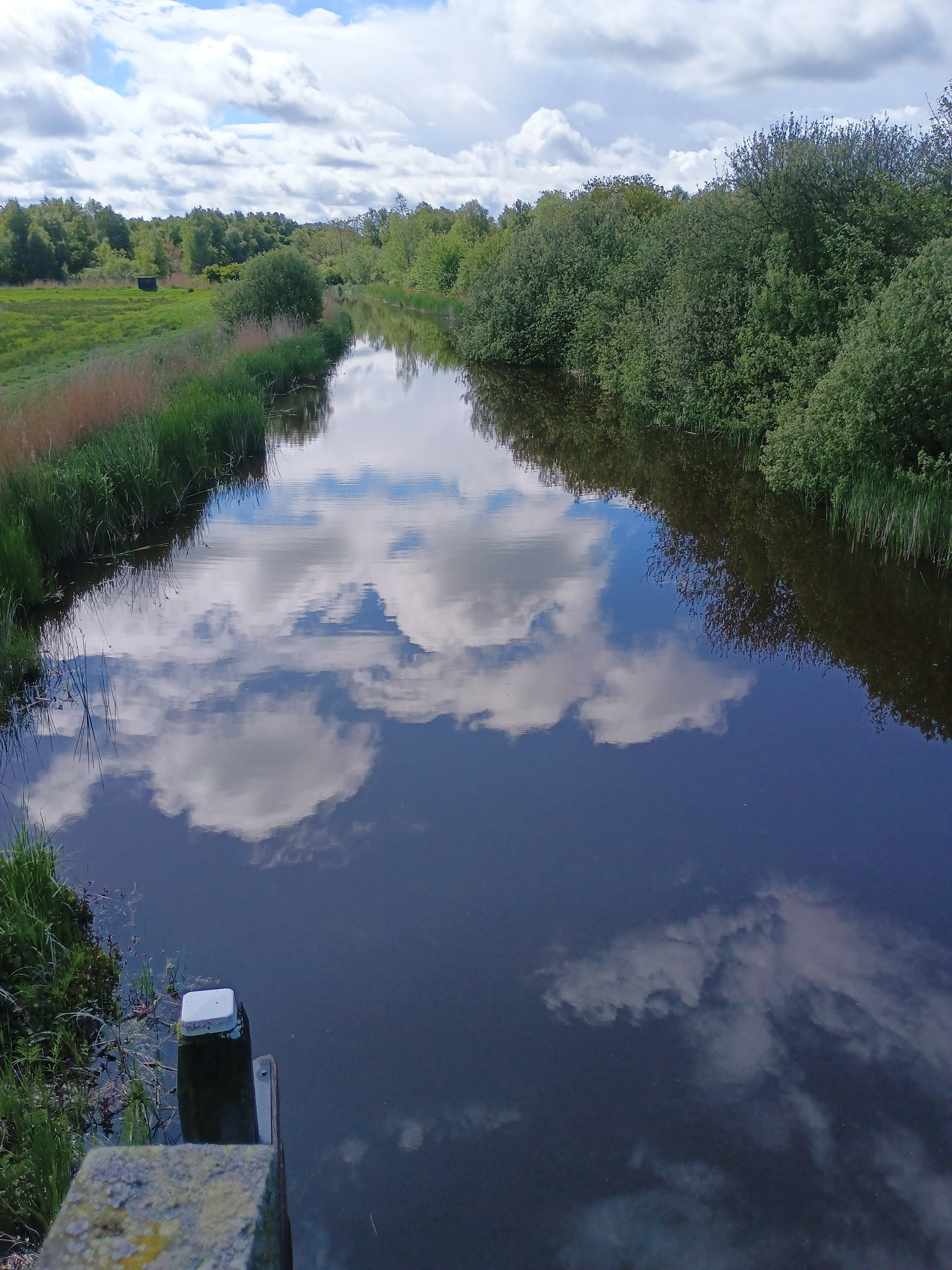
On calm spring days the surroundings are reflected perfectly in the ditches of It Bûtefjild.
Practical information
Access and costs
The walking route is completely free and open all year round. There are no gates, no entrance barriers and no mandatory registration. Parking at the Tourist Transfer Point (TOP) near the station is free (verified May 2025).
Facilities
Toilets: There are no public toilets directly in the area; the nearest facilities are in the village centre of Feanwâlden.
Food and drink: Bring your own; the village has a small supermarket and a few catering establishments, but there is nothing in the area itself.
Accessibility: The greater part of the route is easily walkable in ordinary walking shoes. After rain some sections may be muddy. With a pushchair the route is not comfortable everywhere.
Dogs: Dogs are welcome, but keep them on a lead during the breeding season (March–July) — this is both required and respectful towards the wildlife.
What to bring
Sturdy walking shoes or light trekking shoes (no trainers after rain)
Water and a snack — the route takes well over an hour
Binoculars for birdwatching
Telephoto lens if you want to photograph birds or roe deer
Mosquito repellent in calm summer weather along the banks
The GPX route on your phone or GPS — the waymarking in the area is reasonable but not consistently clear
The meadow area around Feanwâlden at its best: space, silence and water as far as the eye can see.
Frequently asked questions
Is the route suitable for children?
Yes, the 4.3 km loop is perfectly manageable for children from about six years old. The route is flat, there is no climbing involved and there is plenty to see to hold their attention — think young ducks, geese and, if you are lucky, a roe deer.
How busy is It Bûtefjild?
On weekdays, especially early in the morning, you encounter very few people. At weekends and during school holidays it can be slightly busier, but compared with popular walking areas in North Holland or Utrecht it is always quiet.
Can you also cycle here?
Yes. The area around Feanwâlden is part of an extensive cycle junction network. Junction 58 is 900 metres from the TOP near the station. If desired, the walking route can also be incorporated into a cycling trip.
Is there also a longer walking route?
Certainly. It Fryske Gea has mapped out a total of 16 kilometres of walking path in It Bûtefjild, spread across several routes. Some can be combined into a circular walk of 8 to 10 kilometres. These routes are available to download via AllTrails.
When will I see the most wildlife?
Early in the morning, from April to June. Roe deer are most active around sunrise and sunset. Water birds can be seen all year round, but in spring the young are at their most picturesque. Keep your eyes open in autumn too: many bird species pass through on migration.
Is the area worth visiting in winter too?
Yes, though it is more austere. The bare trees offer long views and in frost the area changes character completely. When the ditches have frozen over you may come across skaters — a typically Frisian sight.
In closing
The walking loop near Feanwâlden is no spectacle. There is no grand canyon, no spectacular mountain pass, no iconic viewpoint that everyone wants to photograph. What there is: real nature, close to a village, accessible to everyone and rich enough to return to time and again. I walk this loop so often that I watch the seasons change within it — the geese growing from small to large, the reed shoots from knee-height to head-height, the woodland edge from bare to deep green and back again.
I will not soon forget the roe deer of 13 May. Not because it was such a rare sighting, but because nature at such a moment takes you by the arm and says: look. Here. Now. For those who regularly need that feeling — this is the place.
Useful links
It Fryske Gea — Walking route Bûtefjild: itfryskegea.nl/natuurroutes/butefjild
It Fryske Gea — Area information Bûtefjild: itfryskegea.nl/gebieden/butefjild
Recreatieschap Marrekrite — TOP Feanwâlden: marrekrite.frl — TOP Feanwâlden
AllTrails — Walking routes Feanwâlden: alltrails.com — Feanwâlden walking
NS Journey Planner: ns.nl — plan your journey to Feanwâlden station